|
search place name
|
||
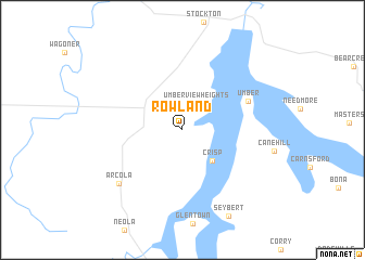
Rowland (Missouri, United States - USA)Rowland is a town in the Missouri region of United States - USA. An overview map of the region around Rowland is displayed below.
regional and 3d topo map of Rowland, United States - USA ::
Rowland airports ::
The nearest airport is SZL - Knobnoster Whiteman Afb, located 127.8 km north of Rowland.
Other airports nearby include TBN - Fort Leonardwood Waynesville Rgnl Arpt At Forney Fld (148.6 km east), HRO - Harrison Boone Co (159.6 km south), FYV - Fayetteville Drake Fld (179.6 km south), COU - Columbia Rgnl (194.6 km north east), Nearby towns ::
Umber View Heights (3.0km north) //
Crisp (4.1km south east) //
Umber (6.1km north east) //
Arcola (7.6km south west) //
Seybert (9.6km south east) //
[all distances 'as the bird flies' and approximate] 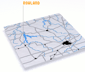 Places with similar names to Rowland, United States - USA ::
Disclaimer :: Information on this page comes without warranty of any kind |
||
|
Where is Rowland? Elevation and coordinates ::
Latitude (lat): 37°35'55"N Longitude (lon): 93°48'57"W
Elevation (approx.): 304m (map arrows pan, magnifying glasses zoom) |
||
|
Visiting Rowland? Hotel/Accommodation ::
Book a hotel in Rowland Travel Guide ::
rental cars ::
car rental offers GPS waypoint ::
download a GPX waypoint (PoI) of Rowland for your GPS receiver
|
||