|
search place name
|
||
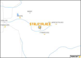
Staley Place (Montana, United States - USA)Staley Place is a town in the Montana region of United States - USA. An overview map of the region around Staley Place is displayed below.
regional and 3d topo map of Staley Place, United States - USA ::
Staley Place airports ::
The nearest airport is HLN - Helena Rgnl, located 109.7 km west of Staley Place.
Other airports nearby include GTF - Great Falls Intl (148.1 km north), Nearby towns ::
Tyman Place (2.8km south east) //
Bill Bracket Place (5.5km north east) //
Hamen (8.1km north west) //
[all distances 'as the bird flies' and approximate]  Places with similar names to Staley Place, United States - USA :: Disclaimer :: Information on this page comes without warranty of any kind |
||
|
Where is Staley Place? Elevation and coordinates ::
Latitude (lat): 46°14'37"N Longitude (lon): 110°39'21"W
Elevation (approx.): 1754m (map arrows pan, magnifying glasses zoom) |
||
|
Visiting Staley Place? Hotel/Accommodation ::
Book a hotel in Staley Place Travel Guide ::
rental cars ::
car rental offers GPS waypoint ::
download a GPX waypoint (PoI) of Staley Place for your GPS receiver
|
||