|
search place name
|
||
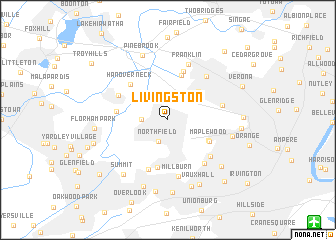
Livingston (New Jersey, United States - USA)Livingston is a town in the New Jersey region of United States - USA. An overview map of the region around Livingston is displayed below.
regional and 3d topo map of Livingston, United States - USA ::
Livingston airports ::
The nearest airport is EWR - Newark Liberty Intl, located 16.9 km south east of Livingston.
Other airports nearby include TEB - Teterboro (22.3 km east), LGA - New York La Guardia (37.4 km east), JFK - New York John F Kennedy Intl (48.5 km east), HPN - White Plains Westchester Co (59.4 km north east), Nearby towns ::
Northfield (2.5km south) //
Morehousetown (2.2km west) //
Beaufort (2.7km north west) //
Roseland (3.3km north east) //
Essex Fells (4.1km north east) //
Saint Cloud (4.2km south east) //
Maplewood (4.3km south east) //
West Caldwell (5.1km north) //
Short Hills (5.4km south) //
Westville (5.6km north) //
Hanover Neck (5.1km north west) //
Hanover (4.5km west) //
White Oak Ridge (5.8km south) //
East Hanover (5.0km north west) //
Newstead North (5.4km south east) //
Pleasantdale (4.9km east) //
Newstead (5.7km south east) //
Millburn (6.3km south) //
Caldwell (5.9km north east) //
Franklin (6.4km north) //
Hutton Park (5.7km east) //
Pine Brook (7.5km north) //
Summit (7.1km south west) //
Wyoming (7.7km south) //
Brantwood (7.7km south) //
South Orange (6.9km south east) //
Vauxhall (7.7km south) //
Baltusrol (8.0km south) //
Springfield (8.1km south) //
[all distances 'as the bird flies' and approximate] 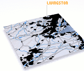 Places with similar names to Livingston, United States - USA ::
// Livingston (US)
// Livingston (US)
// Livingston (US)
// Livingston (US)
// Livingston (US)
// Livingston (US)
// Livingston (US)
// Livingston (US)
// Livingston (US)
// Livingston (US)
Disclaimer :: Information on this page comes without warranty of any kind |
||
|
Where is Livingston? Elevation and coordinates ::
Latitude (lat): 40°47'45"N Longitude (lon): 74°18'55"W
Elevation (approx.): 98m (map arrows pan, magnifying glasses zoom) |
||
|
Visiting Livingston? Hotel/Accommodation ::
Book a hotel in Livingston Travel Guide ::
rental cars ::
car rental offers GPS waypoint ::
download a GPX waypoint (PoI) of Livingston for your GPS receiver
|
||