|
search place name
|
||
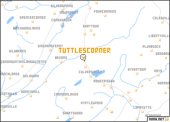
Tuttles Corner (New Jersey, United States - USA)Tuttles Corner is a town in the New Jersey region of United States - USA. An overview map of the region around Tuttles Corner is displayed below.
regional and 3d topo map of Tuttles Corner, United States - USA ::
Tuttles Corner airports ::
The nearest airport is SWF - Newburgh Stewart Intl, located 67.6 km north east of Tuttles Corner.
Other airports nearby include TEB - Teterboro (73.4 km south east), EWR - Newark Liberty Intl (77.5 km south east), LGA - New York La Guardia (91.2 km south east), HPN - White Plains Westchester Co (93.1 km east), Nearby towns ::
Normanook (1.3km south) //
Layton (2.6km north west) //
Culvers Inlet (3.4km south) //
Bevans (4.0km west) //
Hainesville (6.0km north) //
Abertown (6.1km north) //
Mount Pisgah (6.1km south east) //
Shaytown (6.8km north) //
Dingmans Ferry (6.2km north west) //
Branchville (7.1km south east) //
Crandon Lakes (8.8km south) //
Conashaugh (9.0km north west) //
Wallpack Center (7.8km south west) //
Augusta (9.9km south east) //
[all distances 'as the bird flies' and approximate]  Places with similar names to Tuttles Corner, United States - USA ::
// Titlows Corner (US)
Disclaimer :: Information on this page comes without warranty of any kind |
||
|
Where is Tuttles Corner? Elevation and coordinates ::
Latitude (lat): 41°11'53"N Longitude (lon): 74°48'11"W
Elevation (approx.): 187m (map arrows pan, magnifying glasses zoom) |
||
|
Visiting Tuttles Corner? Hotel/Accommodation ::
Book a hotel in Tuttles Corner Travel Guide ::
rental cars ::
car rental offers GPS waypoint ::
download a GPX waypoint (PoI) of Tuttles Corner for your GPS receiver
|
||