|
search place name
|
||
Voorhees (New Jersey, United States - USA)Voorhees is a town in the New Jersey region of United States - USA. An overview map of the region around Voorhees is displayed below.
regional and 3d topo map of Voorhees, United States - USA ::

Voorhees airports ::
The nearest airport is EWR - Newark Liberty Intl, located 35.5 km north east of Voorhees.
Other airports nearby include TTN - Trenton Mercer (36.1 km south west), NEL - Lakehurst Naes (50.9 km south), WRI - Wrightstown Mc Guire Afb (52.5 km south), TEB - Teterboro (54.4 km north east), Nearby towns ::
Lincoln Park (1.5km east) //
Somerset (1.9km north) //
Clyde (2.4km west) //
New Brunswick (2.7km east) //
Adams (3.5km south) //
Berdines Corners (3.0km south east) //
Riverview Manor (3.9km north) //
Sixmile Run (3.6km south west) //
Maple Meade (4.2km south) //
Red Lion (4.3km south) //
Feaster Park (3.4km east) //
Milltown (4.4km south east) //
Middlebush (4.3km north west) //
Farrington Lake Heights (5.5km south east) //
Ukrainian Village (5.8km north west) //
Patricks Corners (6.4km south) //
Society Hill (6.2km north) //
Donaldson Park (5.0km east) //
Highland Park (5.2km east) //
Brookview (6.8km south) //
Mettler (5.3km west) //
Raritan Gardens (5.5km east) //
Black Horse (7.2km south) //
Randolphville (7.0km north) //
Franklin Park (6.4km south west) //
Lawrence Brook Manor (5.8km east) //
Paulas Corners (7.5km south) //
Fieldville (7.6km north) //
Cottageville (7.9km south) //
[all distances 'as the bird flies' and approximate] 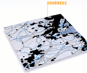 Places with similar names to Voorhees, United States - USA ::
Disclaimer :: Information on this page comes without warranty of any kind |
||
|
Where is Voorhees? Elevation and coordinates ::
Latitude (lat): 40°28'52"N Longitude (lon): 74°29'1"W
Elevation (approx.): 29m (map arrows pan, magnifying glasses zoom) |
||
|
Visiting Voorhees? Hotel/Accommodation ::
Book a hotel in Voorhees Travel Guide ::
rental cars ::
car rental offers GPS waypoint ::
download a GPX waypoint (PoI) of Voorhees for your GPS receiver
|
||