|
search place name
|
||
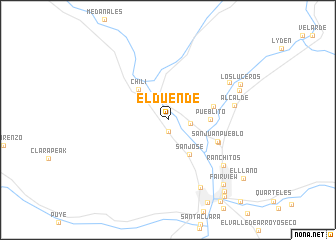
El Duende (New Mexico, United States - USA)El Duende is a town in the New Mexico region of United States - USA. An overview map of the region around El Duende is displayed below.
regional and 3d topo map of El Duende, United States - USA ::
El Duende airports ::
The nearest airport is ABQ - Albuquerque Intl Sunport (Kirtland Afb), located 123.0 km south of El Duende.
Nearby towns ::
Hernandez (1.3km south) //
Chamita (2.1km east) //
La Chuachia (2.8km north west) //
San Jose (4.4km south east) //
Pueblito (3.8km east) //
Chili (4.3km north west) //
Guique (4.4km east) //
San Juan Pueblo (5.0km south east) //
San Juan (5.2km south east) //
Alcalde (6.2km east) //
Estaca (6.9km north east) //
Ranchitos (7.2km south east) //
El Guacho (8.1km south) //
La Villita (7.2km north east) //
Los Luceros (7.7km north east) //
Fairview (8.7km south east) //
Santo Nino (9.4km south east) //
Santo Nino (9.9km south east) //
El Llano (9.4km south east) //
[all distances 'as the bird flies' and approximate] 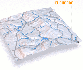 Places with similar names to El Duende, United States - USA ::
Disclaimer :: Information on this page comes without warranty of any kind |
||
|
Where is El Duende? Elevation and coordinates ::
Latitude (lat): 36°4'27"N Longitude (lon): 106°7'10"W
Elevation (approx.): 1738m (map arrows pan, magnifying glasses zoom) |
||
|
Visiting El Duende? Hotel/Accommodation ::
Book a hotel in El Duende Travel Guide ::
rental cars ::
car rental offers GPS waypoint ::
download a GPX waypoint (PoI) of El Duende for your GPS receiver
|
||