|
search place name
|
||
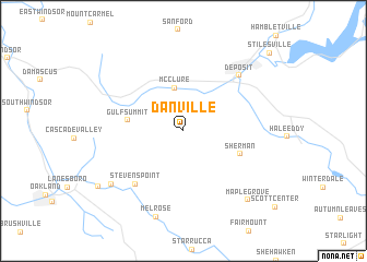
Danville (New York, United States - USA)Danville is a town in the New York region of United States - USA. An overview map of the region around Danville is displayed below.
regional and 3d topo map of Danville, United States - USA ::
Danville airports ::
The nearest airport is SWF - Newburgh Stewart Intl, located 127.3 km south east of Danville.
Other airports nearby include SYR - Syracuse Hancock Intl (132.8 km north west), IPT - Williamsport Rgnl (147.3 km south west), ALB - Albany Intl (160.7 km north east), TEB - Teterboro (175.0 km south east), Nearby towns ::
McClure (4.4km north) //
Gulf Summit (4.4km west) //
Sherman (4.9km south east) //
Stevens Point (6.6km south west) //
Deposit (7.1km north east) //
Brandt (7.8km south west) //
Melrose (9.0km south) //
Maple Grove (8.6km south east) //
Jefferson Junction (8.6km south west) //
Stilesville (10.3km north east) //
[all distances 'as the bird flies' and approximate]  Places with similar names to Danville, United States - USA ::
// Tinfoul (MA)
// Danville (US)
// Danville (US)
// Danville (US)
// Deanyville (US)
// Toneyville (US)
// Danville (US)
// Downieville (US)
// Dunneville (US)
// Tonyville (US)
Disclaimer :: Information on this page comes without warranty of any kind |
||
|
Where is Danville? Elevation and coordinates ::
Latitude (lat): 42°0'32"N Longitude (lon): 75°28'45"W
Elevation (approx.): 566m (map arrows pan, magnifying glasses zoom) |
||
|
Visiting Danville? Hotel/Accommodation ::
Book a hotel in Danville Travel Guide ::
rental cars ::
car rental offers GPS waypoint ::
download a GPX waypoint (PoI) of Danville for your GPS receiver
|
||