|
search place name
|
||
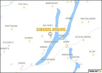
Gibson Landing (New York, United States - USA)Gibson Landing is a town in the New York region of United States - USA. An overview map of the region around Gibson Landing is displayed below.
regional and 3d topo map of Gibson Landing, United States - USA ::
Gibson Landing airports ::
The nearest airport is ROC - Greater Rochester Intl, located 80.7 km north west of Gibson Landing.
Other airports nearby include SYR - Syracuse Hancock Intl (109.7 km north east), BUF - Buffalo Niagara Intl (137.9 km west), IPT - Williamsport Rgnl (141.0 km south), IAG - Niagara Falls Intl (161.1 km north west), Nearby towns ::
Catawba (0.4km south) //
Lakeside Park (1.1km north) //
Pulteney (3.0km north) //
Grove Springs (3.1km south) //
South Pulteney (2.4km west) //
Keuka (3.1km east) //
Urbana (5.3km south) //
Wayne (5.4km south east) //
Sylvan Beach (5.6km south east) //
Glen Grove (6.7km south) //
Elmbois (6.1km west) //
Crosby (7.5km north east) //
Shorewood (9.1km south east) //
[all distances 'as the bird flies' and approximate] 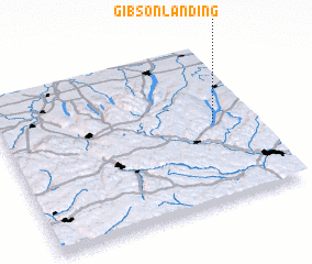 Places with similar names to Gibson Landing, United States - USA ::
Disclaimer :: Information on this page comes without warranty of any kind |
||
|
Where is Gibson Landing? Elevation and coordinates ::
Latitude (lat): 42°29'56"N Longitude (lon): 77°9'32"W
Elevation (approx.): 234m (map arrows pan, magnifying glasses zoom) |
||
|
Visiting Gibson Landing? Hotel/Accommodation ::
Book a hotel in Gibson Landing Travel Guide ::
rental cars ::
car rental offers GPS waypoint ::
download a GPX waypoint (PoI) of Gibson Landing for your GPS receiver
|
||