|
search place name
|
||
Lewiston Heights (New York, United States - USA)Lewiston Heights is a town in the New York region of United States - USA. An overview map of the region around Lewiston Heights is displayed below.
regional and 3d topo map of Lewiston Heights, United States - USA ::

nearby GPS traces from timatio ::
Lewiston Heights airports ::
The nearest airport is IAG - Niagara Falls Intl, located 9.3 km south east of Lewiston Heights.
Other airports nearby include BUF - Buffalo Niagara Intl (34.8 km south east), YTZ - Toronto City Centre (59.3 km north west), YZD - Toronto Downsview (73.2 km north west), YHM - Hamilton (73.7 km west), Nearby towns ::
Lewiston (1.0km north west) //
Rumsey Ridge (0.9km east) //
Escarpment (1.8km east) //
Queenston (1.8km west) //
Riverside Manors (2.7km north west) //
Glenwood (2.6km east) //
Stella Niagara (4.2km north) //
Model City (4.2km north east) //
Pletchers Corners (5.6km south east) //
Collingwood Estates (7.2km north) //
Blairville (7.6km north) //
Niagara Falls (7.5km south) //
Colonial Village (6.1km south east) //
Youngstown Estates (8.0km north) //
Niagara Falls (8.3km south) //
Stamford (6.8km south west) //
[all distances 'as the bird flies' and approximate] 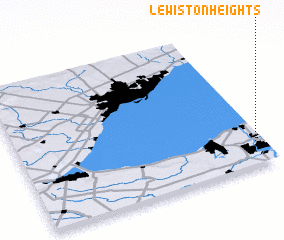 Places with similar names to Lewiston Heights, United States - USA ::
// Lewistown Heights (US)
Disclaimer :: Information on this page comes without warranty of any kind |
||
|
Where is Lewiston Heights? Elevation and coordinates ::
Latitude (lat): 43°9'57"N Longitude (lon): 79°1'42"W
Elevation (approx.): 186m (map arrows pan, magnifying glasses zoom) |
||
|
Visiting Lewiston Heights? Hotel/Accommodation ::
Book a hotel in Lewiston Heights Travel Guide ::
rental cars ::
car rental offers GPS waypoint ::
download a GPX waypoint (PoI) of Lewiston Heights for your GPS receiver
|
||