|
search place name
|
||
Porterville (New York, United States - USA)Porterville is a town in the New York region of United States - USA. An overview map of the region around Porterville is displayed below.
regional and 3d topo map of Porterville, United States - USA ::

Porterville airports ::
The nearest airport is BUF - Buffalo Niagara Intl, located 22.2 km north west of Porterville.
Other airports nearby include IAG - Niagara Falls Intl (47.6 km north west), ROC - Greater Rochester Intl (80.7 km north east), YTZ - Toronto City Centre (115.5 km north west), YHM - Hamilton (120.4 km west), Nearby towns ::
Wales Center (3.1km south east) //
East Elma (3.7km north west) //
Marilla (5.5km north) //
Williston (5.1km north east) //
Colegrave (6.0km south) //
East Aurora (5.5km south west) //
Blakeley (7.0km south west) //
Jamison Road (5.7km west) //
Billington Heights (6.0km west) //
Wales Hollow (7.5km south east) //
[all distances 'as the bird flies' and approximate] 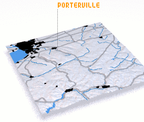 Places with similar names to Porterville, United States - USA ::
// Porterville (US)
// Porterville (US)
// Porterville (ZA)
// Porterville (US)
// Porterville (US)
// Porterville (US)
// Pear Tree Valley (JM)
// Prêtreville (FR)
// Perdreauville (FR)
// Perdreauville (FR)
Disclaimer :: Information on this page comes without warranty of any kind |
||
|
Where is Porterville? Elevation and coordinates ::
Latitude (lat): 42°47'25"N Longitude (lon): 78°33'14"W
Elevation (approx.): 279m (map arrows pan, magnifying glasses zoom) |
||
|
Visiting Porterville? Hotel/Accommodation ::
Book a hotel in Porterville Travel Guide ::
rental cars ::
car rental offers GPS waypoint ::
download a GPX waypoint (PoI) of Porterville for your GPS receiver
|
||