|
search place name
|
||
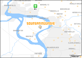
Sour Spring Grove (New York, United States - USA)Sour Spring Grove is a town in the New York region of United States - USA. An overview map of the region around Sour Spring Grove is displayed below.
regional and 3d topo map of Sour Spring Grove, United States - USA ::
Sour Spring Grove airports ::
The nearest airport is IAG - Niagara Falls Intl, located 10.7 km north of Sour Spring Grove.
Other airports nearby include BUF - Buffalo Niagara Intl (17.5 km south east), YTZ - Toronto City Centre (78.4 km north west), YHM - Hamilton (84.3 km west), YZD - Toronto Downsview (92.3 km north west), Nearby towns ::
Grandyle Village (3.1km south west) //
Edgewater (4.0km north) //
Tonawanda (3.6km east) //
Ferry Village (5.0km south west) //
Sandy Beach (5.7km north west) //
Oakfield (5.8km south west) //
North Tonawanda (5.6km north east) //
Kenmore (6.7km south east) //
Ellwood Park (7.0km south east) //
Park Village (6.5km east) //
Saint Johnsburg (8.9km north) //
La Salle (8.6km north west) //
Wurlitzer Park Village (7.8km north east) //
Nashville (8.6km north east) //
Sawyer (8.6km north east) //
[all distances 'as the bird flies' and approximate] 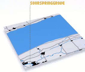 Places with similar names to Sour Spring Grove, United States - USA :: Disclaimer :: Information on this page comes without warranty of any kind |
||
|
Where is Sour Spring Grove? Elevation and coordinates ::
Latitude (lat): 43°0'44"N Longitude (lon): 78°55'24"W
Elevation (approx.): 183m (map arrows pan, magnifying glasses zoom) |
||
|
Visiting Sour Spring Grove? Hotel/Accommodation ::
Book a hotel in Sour Spring Grove Travel Guide ::
rental cars ::
car rental offers GPS waypoint ::
download a GPX waypoint (PoI) of Sour Spring Grove for your GPS receiver
|
||