|
search place name
|
||
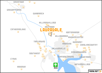
Lauradale (North Carolina, United States - USA)Lauradale is a town in the North Carolina region of United States - USA. An overview map of the region around Lauradale is displayed below.
regional and 3d topo map of Lauradale, United States - USA ::
Lauradale airports ::
The nearest airport is NCA - Jacksonville New River Mcas, located 10.5 km south of Lauradale.
Other airports nearby include EWN - New Bern Craven Co Rgnl (48.2 km north east), NKT - Cherry Point Mcas (53.7 km east), ILM - Wilmington Intl (71.8 km south west), GSB - Goldsboro Seymour Johnson Afb (75.4 km north west), Nearby towns ::
Shamrock Village (0.6km north) //
Raintree (1.4km north) //
Deerfield (1.3km north east) //
Half Moon Heights (1.7km north) //
Edgewood Park (2.4km north) //
Half Moon (2.7km north) //
Willow Woods (3.3km east) //
Mill Pond Meadows (4.2km north) //
Town Ranch Heights (4.1km south west) //
Indian Springs (3.7km north east) //
Mill Pond Village (4.4km north) //
Aldersgate (3.9km south east) //
McArthur Estates (4.6km north) //
Oakhurst River Estates (4.7km south) //
Branchwood (4.2km south east) //
Tar Landing (4.5km south west) //
Hickory Hills West Trailer Park (5.2km south) //
Greystone (4.7km south west) //
Pine Forest Acres (5.1km south west) //
Triangle Trailer Park (5.6km south) //
Stillwood (5.3km south west) //
Houston Mobile Home Park (5.6km south) //
Greencrest (5.4km south west) //
Warrens Trailer Park (5.8km south) //
Jacksonville (5.8km south east) //
Faries Trailer Park (6.0km south west) //
Hawkside (6.0km south east) //
Georgetown (6.8km south) //
Springdale Acres (7.0km south) //
[all distances 'as the bird flies' and approximate]  Places with similar names to Lauradale, United States - USA ::
Disclaimer :: Information on this page comes without warranty of any kind |
||
|
Where is Lauradale? Elevation and coordinates ::
Latitude (lat): 34°48'7"N Longitude (lon): 77°27'18"W
Elevation (approx.): 7m (map arrows pan, magnifying glasses zoom) |
||
|
Visiting Lauradale? Hotel/Accommodation ::
Book a hotel in Lauradale Travel Guide ::
rental cars ::
car rental offers GPS waypoint ::
download a GPX waypoint (PoI) of Lauradale for your GPS receiver
|
||