|
search place name
|
||
Mercer Landing (North Carolina, United States - USA)Mercer Landing is a town in the North Carolina region of United States - USA. An overview map of the region around Mercer Landing is displayed below.
regional and 3d topo map of Mercer Landing, United States - USA ::

Mercer Landing airports ::
The nearest airport is ILM - Wilmington Intl, located 46.1 km north east of Mercer Landing.
Other airports nearby include MYR - Myrtle Beach Intl (71.1 km south west), NCA - Jacksonville New River Mcas (110.6 km north east), FLO - Florence Rgnl (139.1 km west), POB - Fayetteville Pope Afb (151.5 km north west), Nearby towns ::
Sandy Hill (1.1km north east) //
Varnum (2.3km south east) //
Dixon Landing (2.7km south east) //
Varnamtown (3.4km south) //
Lennon Crossroads (3.6km north) //
Supply (6.4km north west) //
Secession (6.2km south west) //
Sivey Town (6.1km west) //
Oak Grove (6.8km north west) //
Doe Creek (7.4km north west) //
Holden Beach (8.2km south west) //
Middle River (9.6km north) //
Oak Island (9.1km south east) //
[all distances 'as the bird flies' and approximate] 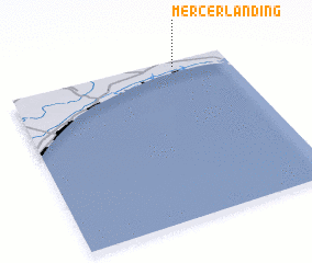 Places with similar names to Mercer Landing, United States - USA :: Disclaimer :: Information on this page comes without warranty of any kind |
||
|
Where is Mercer Landing? Elevation and coordinates ::
Latitude (lat): 33°57'54"N Longitude (lon): 78°14'26"W
Elevation (approx.): -1m (map arrows pan, magnifying glasses zoom) |
||
|
Visiting Mercer Landing? Hotel/Accommodation ::
Book a hotel in Mercer Landing Travel Guide ::
rental cars ::
car rental offers GPS waypoint ::
download a GPX waypoint (PoI) of Mercer Landing for your GPS receiver
|
||