|
search place name
|
||
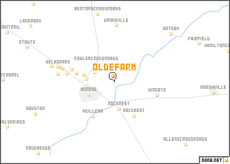
Olde Farm (North Carolina, United States - USA)Olde Farm is a town in the North Carolina region of United States - USA. An overview map of the region around Olde Farm is displayed below.
regional and 3d topo map of Olde Farm, United States - USA ::
Olde Farm airports ::
The nearest airport is CLT - Charlotte Douglas Intl, located 45.7 km north west of Olde Farm.
Other airports nearby include HKY - Hickory Rgnl (114.3 km north west), SSC - Sumter Shaw Afb (114.5 km south), FLO - Florence Rgnl (116.1 km south east), INT - Winston-salem Smith Reynolds (128.0 km north), Nearby towns ::
Broadview Acres (3.1km north west) //
Crestview Acres (3.4km north west) //
Fowler Crossroads (3.8km north west) //
Rock Rest (4.4km south) //
Hillsdale (3.7km west) //
Monroe (4.1km south west) //
Kimberly Courts (4.2km west) //
Rock Rest (6.1km south east) //
Camelot (5.3km west) //
Heil Leah (6.4km south west) //
Wingate (6.1km east) //
Rolling Hills (6.1km west) //
Briarwood Acres (6.6km west) //
Clubview Acres (7.3km west) //
Dogwood Acres (7.6km west) //
[all distances 'as the bird flies' and approximate]  Places with similar names to Olde Farm, United States - USA ::
Disclaimer :: Information on this page comes without warranty of any kind |
||
|
Where is Olde Farm? Elevation and coordinates ::
Latitude (lat): 35°0'15"N Longitude (lon): 80°30'41"W
Elevation (approx.): 178m (map arrows pan, magnifying glasses zoom) |
||
|
Visiting Olde Farm? Hotel/Accommodation ::
Book a hotel in Olde Farm Travel Guide ::
rental cars ::
car rental offers GPS waypoint ::
download a GPX waypoint (PoI) of Olde Farm for your GPS receiver
|
||