|
search place name
|
||
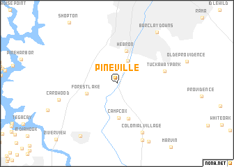
Pineville (North Carolina, United States - USA)Pineville is a town in the North Carolina region of United States - USA. An overview map of the region around Pineville is displayed below.
regional and 3d topo map of Pineville, United States - USA ::
Pineville airports ::
The nearest airport is CLT - Charlotte Douglas Intl, located 15.2 km north of Pineville.
Other airports nearby include HKY - Hickory Rgnl (85.8 km north west), CAE - Colombia Columbia Metropolitan (128.6 km south), SSC - Sumter Shaw Afb (129.1 km south), INT - Winston-salem Smith Reynolds (131.5 km north east), Nearby towns ::
Sterling (2.8km north) //
Sharonbrook (3.9km north) //
Forest Lake (4.3km west) //
Hebron (5.3km north) //
Camp Cox (5.5km south) //
Barberville (5.8km south) //
Tuckaway Park (6.6km east) //
Colonial Village (8.5km south east) //
Fort Mill (9.7km south west) //
Barclay Downs (9.8km north east) //
[all distances 'as the bird flies' and approximate] 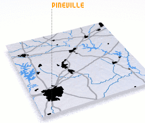 Places with similar names to Pineville, United States - USA ::
// Payneville (US)
// Pineville (US)
// Pineville (US)
// Pine Valley (US)
// Pineville (US)
// Pineville (US)
// Pennville (US)
// Pine Valley (US)
// Pine Valley (US)
// Pineville (US)
Disclaimer :: Information on this page comes without warranty of any kind |
||
|
Where is Pineville? Elevation and coordinates ::
Latitude (lat): 35°4'59"N Longitude (lon): 80°53'33"W
Elevation (approx.): 179m (map arrows pan, magnifying glasses zoom) |
||
|
Visiting Pineville? Hotel/Accommodation ::
Book a hotel in Pineville Travel Guide ::
rental cars ::
car rental offers GPS waypoint ::
download a GPX waypoint (PoI) of Pineville for your GPS receiver
|
||