|
search place name
|
||
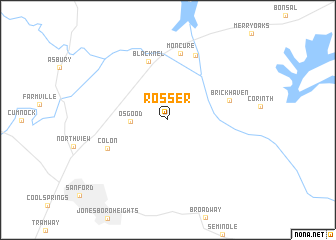
Rosser (North Carolina, United States - USA)Rosser is a town in the North Carolina region of United States - USA. An overview map of the region around Rosser is displayed below.
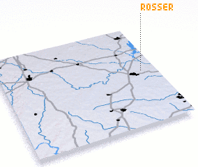
regional and 3d topo map of Rosser, United States - USA ::
Rosser airports ::
The nearest airport is POB - Fayetteville Pope Afb, located 43.2 km south of Rosser.
Other airports nearby include RDU - Raleigh-durham Raleigh Durham Intl (45.1 km north east), GSB - Goldsboro Seymour Johnson Afb (105.4 km east), INT - Winston-salem Smith Reynolds (120.6 km north west), FLO - Florence Rgnl (162.6 km south), Nearby towns ::
 Places with similar names to Rosser, United States - USA ::
Disclaimer :: Information on this page comes without warranty of any kind |
||
|
Where is Rosser? Elevation and coordinates ::
Latitude (lat): 35°33'19"N Longitude (lon): 79°5'29"W
Elevation (approx.): 64m (map arrows pan, magnifying glasses zoom) |
||
|
Visiting Rosser? Hotel/Accommodation ::
Book a hotel in Rosser Travel Guide ::
rental cars ::
car rental offers GPS waypoint ::
download a GPX waypoint (PoI) of Rosser for your GPS receiver
|
||