|
search place name
|
||
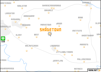
Shadetown (North Carolina, United States - USA)Shadetown is a town in the North Carolina region of United States - USA. An overview map of the region around Shadetown is displayed below.
regional and 3d topo map of Shadetown, United States - USA ::
Shadetown airports ::
The nearest airport is GSB - Goldsboro Seymour Johnson Afb, located 14.4 km west of Shadetown.
Other airports nearby include EWN - New Bern Craven Co Rgnl (75.6 km south east), NCA - Jacksonville New River Mcas (78.3 km south east), NKT - Cherry Point Mcas (97.6 km south east), RDU - Raleigh-durham Raleigh Durham Intl (106.9 km north west), Nearby towns ::
Parkstown (3.6km north west) //
La Grange (4.7km south) //
Jason (4.5km north east) //
Best (4.2km west) //
Eastwood (5.8km south) //
Cokers Crossroads (7.4km north west) //
Walnut Creek (7.2km south west) //
Little Baltimore (8.0km south east) //
Oakdale (8.7km north) //
Hood Swamp (9.3km north west) //
Deerwood (9.1km south west) //
Fields (9.6km south east) //
[all distances 'as the bird flies' and approximate] 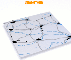 Places with similar names to Shadetown, United States - USA ::
// Chetdino (RU)
// Shadtown (US)
// Chauddadona (BD)
// Chitutane (MZ)
// Chu-tu-t'an (TW)
// Chotětín (CZ)
// Chitudian (CN)
// Shitoutan (CN)
// Châteaudun (FR)
Disclaimer :: Information on this page comes without warranty of any kind |
||
|
Where is Shadetown? Elevation and coordinates ::
Latitude (lat): 35°20'51"N Longitude (lon): 77°48'10"W
Elevation (approx.): 29m (map arrows pan, magnifying glasses zoom) |
||
|
Visiting Shadetown? Hotel/Accommodation ::
Book a hotel in Shadetown Travel Guide ::
rental cars ::
car rental offers GPS waypoint ::
download a GPX waypoint (PoI) of Shadetown for your GPS receiver
|
||