|
search place name
|
||
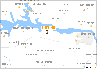
Thelma (North Carolina, United States - USA)Thelma is a town in the North Carolina region of United States - USA. An overview map of the region around Thelma is displayed below.
regional and 3d topo map of Thelma, United States - USA ::
Thelma airports ::
The nearest airport is RDU - Raleigh-durham Raleigh Durham Intl, located 111.0 km south west of Thelma.
Other airports nearby include RIC - Richmond Intl (122.4 km north), GSB - Goldsboro Seymour Johnson Afb (126.4 km south), PHF - Newport News Williamsburg Intl (137.3 km north east), NGU - Norfolk Ns (144.1 km east), Nearby towns ::
Vultare (5.8km north east) //
Hinnes Crossroads (7.5km south) //
Henrico (7.9km north west) //
Stancell (9.4km north east) //
Roper Springs (8.6km south west) //
[all distances 'as the bird flies' and approximate] 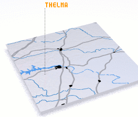 Places with similar names to Thelma, United States - USA ::
Disclaimer :: Information on this page comes without warranty of any kind |
||
|
Where is Thelma? Elevation and coordinates ::
Latitude (lat): 36°28'13"N Longitude (lon): 77°47'37"W
Elevation (approx.): 71m (map arrows pan, magnifying glasses zoom) |
||
|
Visiting Thelma? Hotel/Accommodation ::
Book a hotel in Thelma Travel Guide ::
rental cars ::
car rental offers GPS waypoint ::
download a GPX waypoint (PoI) of Thelma for your GPS receiver
|
||