|
search place name
|
||
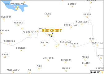
Burkhart (Ohio, United States - USA)Burkhart is a town in the Ohio region of United States - USA. An overview map of the region around Burkhart is displayed below.
regional and 3d topo map of Burkhart, United States - USA ::
Burkhart airports ::
The nearest airport is PIT - Pittsburgh (pennsylva) Pittsburgh Intl, located 117.4 km north east of Burkhart.
Other airports nearby include AKR - Akron Fulton Intl (139.7 km north), CMH - Port Columbus Intl (141.2 km west), LCK - Columbus Rickenbacker Intl (142.6 km west), EKN - Elkins Randolph Co Jennings Randolph (157.1 km south east), Nearby towns ::
Brister (1.5km north west) //
Hamilton (3.3km south east) //
Jacobsburg (3.6km south) //
Swazey (3.5km south west) //
Herlan (3.4km north west) //
Doherty (4.5km north west) //
Lewisville (4.6km south east) //
Monroefield (6.2km north east) //
Calais (7.6km north) //
Summerfield (6.3km west) //
Stafford (8.5km south) //
Decker (7.0km south east) //
[all distances 'as the bird flies' and approximate] 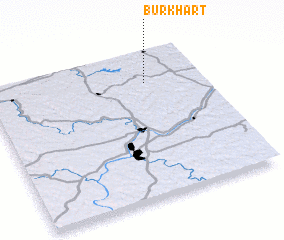 Places with similar names to Burkhart, United States - USA ::
// Burkhart (US)
Disclaimer :: Information on this page comes without warranty of any kind |
||
|
Where is Burkhart? Elevation and coordinates ::
Latitude (lat): 39°47'21"N Longitude (lon): 81°15'47"W
Elevation (approx.): 280m (map arrows pan, magnifying glasses zoom) |
||
|
Visiting Burkhart? Hotel/Accommodation ::
Book a hotel in Burkhart Travel Guide ::
rental cars ::
car rental offers GPS waypoint ::
download a GPX waypoint (PoI) of Burkhart for your GPS receiver
|
||