|
search place name
|
||
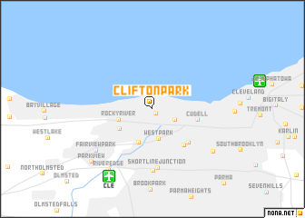
Clifton Park (Ohio, United States - USA)Clifton Park is a town in the Ohio region of United States - USA. An overview map of the region around Clifton Park is displayed below.
regional and 3d topo map of Clifton Park, United States - USA ::
nearby GPS traces from timatio ::
Clifton Park airports ::
The nearest airport is CLE - Cleveland Hopkins Intl, located 9.3 km south west of Clifton Park.
Other airports nearby include AKR - Akron Fulton Intl (57.3 km south east), YNG - Youngstown Warren Rgnl (97.3 km east), YQG - Windsor (129.7 km north west), DET - Detroit Coleman A Young Muni (143.2 km north west), Nearby towns ::
Lakewood (0.7km south east) //
Birds Nest (2.5km south east) //
Westpark (3.7km south) //
Rocky River (3.3km south west) //
Kamms Corner (4.3km south) //
Rockport (3.9km south west) //
Cudell (4.4km east) //
Linndale (5.4km south east) //
Gresham (5.4km south east) //
North Linndale (5.3km south east) //
Short Line Junction (7.2km south) //
McKinley (7.6km south) //
Fairview Park (7.3km south west) //
Brooklyn (7.7km south east) //
River Edge (8.5km south west) //
Parkview (8.6km south west) //
[all distances 'as the bird flies' and approximate]  Places with similar names to Clifton Park, United States - USA ::
// Clifton Park (US)
Disclaimer :: Information on this page comes without warranty of any kind |
||
|
Where is Clifton Park? Elevation and coordinates ::
Latitude (lat): 41°29'14"N Longitude (lon): 81°48'9"W
Elevation (approx.): 200m (map arrows pan, magnifying glasses zoom) |
||
|
Visiting Clifton Park? Hotel/Accommodation ::
Book a hotel in Clifton Park Travel Guide ::
rental cars ::
car rental offers GPS waypoint ::
download a GPX waypoint (PoI) of Clifton Park for your GPS receiver
|
||