|
search place name
|
||
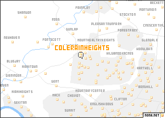
Colerain Heights (Ohio, United States - USA)Colerain Heights is a town in the Ohio region of United States - USA. An overview map of the region around Colerain Heights is displayed below.
regional and 3d topo map of Colerain Heights, United States - USA ::
Colerain Heights airports ::
The nearest airport is LUK - Cincinnati Muni Lunken Fld, located 21.7 km south east of Colerain Heights.
Other airports nearby include CVG - Cincinnati Northern Kentucky Intl (22.1 km south), DAY - James M Cox Dayton Intl (80.4 km north east), FFO - Dayton Wright Patterson Afb (80.4 km north east), LOU - Louisville Bowman Fld (145.7 km south west), Nearby towns ::
Wardwood Acres (0.6km east) //
Dornbusch (0.8km north west) //
Crestwood Acres (1.1km south west) //
Northgate (1.4km north) //
White Oak Meadows (1.5km south) //
Northbrook (1.4km north east) //
Galaxy Acres (1.5km east) //
Bevis (1.9km north) //
Chesswood Acres (1.9km south) //
Autumn Acres (2.0km south) //
Groesbeck (2.2km south east) //
Barnesburg (2.5km south west) //
White Oak (3.1km south) //
Dry Ridge (2.8km north west) //
Oakdale (3.3km south) //
Skyline Acres (3.0km south east) //
Saint Jacobs (4.5km south) //
Lynnview (3.6km east) //
Mount Healthy Heights (4.2km north east) //
New Burlington (4.1km north east) //
Golfway Acres (4.6km south east) //
North College Hill (4.8km south east) //
Mount Healthy (4.6km east) //
Fox Acres (5.6km south east) //
Dunlap (6.0km north) //
Mount Airy (6.0km south east) //
College Hill (6.1km south east) //
Teakwood Acres (6.1km south east) //
Pleasant Run (7.2km north east) //
[all distances 'as the bird flies' and approximate] 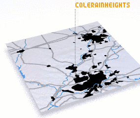 Places with similar names to Colerain Heights, United States - USA :: Disclaimer :: Information on this page comes without warranty of any kind |
||
|
Where is Colerain Heights? Elevation and coordinates ::
Latitude (lat): 39°14'26"N Longitude (lon): 84°35'53"W
Elevation (approx.): 271m (map arrows pan, magnifying glasses zoom) |
||
|
Visiting Colerain Heights? Hotel/Accommodation ::
Book a hotel in Colerain Heights Travel Guide ::
rental cars ::
car rental offers GPS waypoint ::
download a GPX waypoint (PoI) of Colerain Heights for your GPS receiver
|
||