|
search place name
|
||
Craigton (Ohio, United States - USA)Craigton is a town in the Ohio region of United States - USA. An overview map of the region around Craigton is displayed below.
regional and 3d topo map of Craigton, United States - USA ::

Craigton airports ::
The nearest airport is AKR - Akron Fulton Intl, located 62.1 km north east of Craigton.
Other airports nearby include CLE - Cleveland Hopkins Intl (79.4 km north), CMH - Port Columbus Intl (106.0 km south west), LCK - Columbus Rickenbacker Intl (124.0 km south west), YNG - Youngstown Warren Rgnl (131.8 km north east), Nearby towns ::
Springville (3.8km north east) //
Blachleyville (5.4km north) //
Big Prairie (5.9km south) //
Centerville (5.9km south east) //
Funk (5.6km north west) //
Shreve (5.6km south east) //
Millbrook (5.4km east) //
Lakeland Beach (6.5km south west) //
McZena (6.1km west) //
Lake Fork (7.0km north west) //
Lakeville (8.2km south west) //
Stringtown (7.5km south east) //
[all distances 'as the bird flies' and approximate] 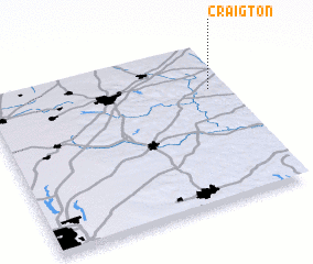 Places with similar names to Craigton, United States - USA ::
// Karakitan (PH)
// Crookton (US)
// Gorgoteni (RO)
// Karagodino (RU)
// Karakitany (RU)
// Korkodin (RU)
// Korkodon (RU)
// Krekhtino (RU)
// Craigtown (US)
// Greggton (US)
Disclaimer :: Information on this page comes without warranty of any kind |
||
|
Where is Craigton? Elevation and coordinates ::
Latitude (lat): 40°42'59"N Longitude (lon): 82°4'13"W
Elevation (approx.): 291m (map arrows pan, magnifying glasses zoom) |
||
|
Visiting Craigton? Hotel/Accommodation ::
Book a hotel in Craigton Travel Guide ::
rental cars ::
car rental offers GPS waypoint ::
download a GPX waypoint (PoI) of Craigton for your GPS receiver
|
||