|
search place name
|
||
Duck Creek (Ohio, United States - USA)Duck Creek is a town in the Ohio region of United States - USA. An overview map of the region around Duck Creek is displayed below.
regional and 3d topo map of Duck Creek, United States - USA ::

Duck Creek airports ::
The nearest airport is YNG - Youngstown Warren Rgnl, located 20.4 km north east of Duck Creek.
Other airports nearby include AKR - Akron Fulton Intl (50.8 km west), CLE - Cleveland Hopkins Intl (85.2 km west), PIT - Pittsburgh (pennsylva) Pittsburgh Intl (93.0 km south east), YXU - London (208.9 km north), Nearby towns ::
Lordstown (2.4km east) //
Tiger (3.9km south west) //
Soaptown (5.6km south east) //
Center World (7.2km north) //
North Jackson (7.7km south) //
Austin Village (8.9km north) //
Pricetown (7.6km south west) //
Braceville (9.0km north west) //
Warren (9.8km north east) //
Blanco (10.8km south west) //
[all distances 'as the bird flies' and approximate] 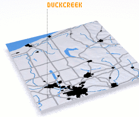 Places with similar names to Duck Creek, United States - USA ::
// Dogcreek (US)
// Duck Creek (US)
// Dog Creek (US)
// Duck Creek (US)
// Dog Creek (CA)
// Duck Creek (US)
// Dugui Qirag (CN)
Disclaimer :: Information on this page comes without warranty of any kind |
||
|
Where is Duck Creek? Elevation and coordinates ::
Latitude (lat): 41°9'56"N Longitude (lon): 80°53'12"W
Elevation (approx.): 297m (map arrows pan, magnifying glasses zoom) |
||
|
Visiting Duck Creek? Hotel/Accommodation ::
Book a hotel in Duck Creek Travel Guide ::
rental cars ::
car rental offers GPS waypoint ::
download a GPX waypoint (PoI) of Duck Creek for your GPS receiver
|
||