|
search place name
|
||
Huber Ridge (Ohio, United States - USA)Huber Ridge is a town in the Ohio region of United States - USA. An overview map of the region around Huber Ridge is displayed below.
regional and 3d topo map of Huber Ridge, United States - USA ::

Huber Ridge airports ::
The nearest airport is CMH - Port Columbus Intl, located 10.3 km south of Huber Ridge.
Other airports nearby include LCK - Columbus Rickenbacker Intl (30.5 km south), FFO - Dayton Wright Patterson Afb (101.0 km west), DAY - James M Cox Dayton Intl (113.2 km west), AKR - Akron Fulton Intl (161.8 km north east), Nearby towns ::
Blendon Corner (1.4km south west) //
Pinhook (1.8km east) //
Gould Park (2.7km south east) //
Minerva Park (2.7km south west) //
Central College (2.8km north east) //
Westerville (4.3km north) //
Sharon (3.4km west) //
Moores Corners (4.5km south west) //
Parks Mills (6.0km south) //
Mifflinville (6.7km south west) //
Clinton (6.5km south west) //
Mackstown (6.9km north east) //
Gahanna (8.3km south) //
East Linden (8.5km south) //
Linden (9.0km south west) //
Harlem (9.6km north east) //
[all distances 'as the bird flies' and approximate] 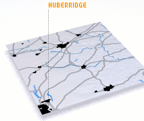
Disclaimer :: Information on this page comes without warranty of any kind |
||
|
Where is Huber Ridge? Elevation and coordinates ::
Latitude (lat): 40°5'19"N Longitude (lon): 82°55'0"W
Elevation (approx.): 249m (map arrows pan, magnifying glasses zoom) |
||
|
Visiting Huber Ridge? Hotel/Accommodation ::
Book a hotel in Huber Ridge Travel Guide ::
rental cars ::
car rental offers GPS waypoint ::
download a GPX waypoint (PoI) of Huber Ridge for your GPS receiver
|
||