|
search place name
|
||
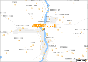
Jacksonville (Ohio, United States - USA)Jacksonville is a town in the Ohio region of United States - USA. An overview map of the region around Jacksonville is displayed below.
regional and 3d topo map of Jacksonville, United States - USA ::
Jacksonville airports ::
The nearest airport is PIT - Pittsburgh (pennsylva) Pittsburgh Intl, located 34.8 km north east of Jacksonville.
Other airports nearby include YNG - Youngstown Warren Rgnl (98.8 km north), AKR - Akron Fulton Intl (103.4 km north west), CLE - Cleveland Hopkins Intl (155.6 km north west), EKN - Elkins Randolph Co Jennings Randolph (176.9 km south), Nearby towns ::
La Belle View (1.1km west) //
Archer Heights (1.6km south east) //
East Steubenville (2.0km south east) //
Steubenville (1.9km west) //
Weirton Junction (2.4km north east) //
Fishersville (2.7km south west) //
Marland Heights (2.9km north) //
Coketown (3.0km south) //
Alikanna (2.7km north west) //
Stanton Park (2.9km north west) //
Pottery Addition (3.5km north) //
Holidays Cove (3.6km north east) //
Altamont (4.4km south) //
Hillsboro (4.5km south) //
The Orchard (4.6km south) //
Parkview (4.5km south east) //
Follansbee (5.1km south) //
Mingo Junction (5.6km south) //
Weirton (5.5km north) //
Longview Heights (5.1km south east) //
Logrow (4.6km east) //
Costonia (6.1km north) //
Hooverson Heights (6.0km south east) //
Vermont Terrace (6.3km north east) //
Deandale (7.0km south) //
Pleasant Hill (6.6km north west) //
Gould (7.0km south west) //
Weircrest (7.7km north) //
Colliers (6.0km east) //
[all distances 'as the bird flies' and approximate]  Places with similar names to Jacksonville, United States - USA ::
// Jacksonville (US)
// Jacksonville (US)
// Jacksonville (US)
// Jacksonville (US)
// Jacksonville (US)
// Jacksonville (US)
// Jacksonville (US)
// Jacksonville (US)
// Jacksonville (US)
// Jacksonville (US)
Disclaimer :: Information on this page comes without warranty of any kind |
||
|
Where is Jacksonville? Elevation and coordinates ::
Latitude (lat): 40°22'20"N Longitude (lon): 80°36'42"W
Elevation (approx.): 214m (map arrows pan, magnifying glasses zoom) |
||
|
Visiting Jacksonville? Hotel/Accommodation ::
Book a hotel in Jacksonville Travel Guide ::
rental cars ::
car rental offers GPS waypoint ::
download a GPX waypoint (PoI) of Jacksonville for your GPS receiver
|
||