|
search place name
|
||
Kimbolton (Ohio, United States - USA)Kimbolton is a town in the Ohio region of United States - USA. An overview map of the region around Kimbolton is displayed below.
regional and 3d topo map of Kimbolton, United States - USA ::

Kimbolton airports ::
The nearest airport is AKR - Akron Fulton Intl, located 98.6 km north of Kimbolton.
Other airports nearby include CMH - Port Columbus Intl (113.9 km west), PIT - Pittsburgh (pennsylva) Pittsburgh Intl (119.9 km east), LCK - Columbus Rickenbacker Intl (121.8 km west), CLE - Cleveland Hopkins Intl (141.8 km north), Nearby towns ::
North Salem (2.5km south east) //
Guernsey (3.6km north west) //
Tyner (5.3km south) //
Postboy (8.3km north) //
Birds Run (6.6km west) //
Booth (9.1km north) //
Indian Camp (9.0km south west) //
[all distances 'as the bird flies' and approximate] 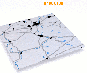 Places with similar names to Kimbolton, United States - USA ::
// Kimballton (US)
// Cambellton (ZA)
// Kimbolton (NZ)
// Kimmelton (US)
// Kimballton (US)
// Kamileten (TP)
// Kamāl ed Dīnī (IR)
// Cambelton (JM)
// Gammelhyttan (SE)
// Kimbolton (GB)
Disclaimer :: Information on this page comes without warranty of any kind |
||
|
Where is Kimbolton? Elevation and coordinates ::
Latitude (lat): 40°9'10"N Longitude (lon): 81°34'20"W
Elevation (approx.): 244m (map arrows pan, magnifying glasses zoom) |
||
|
Visiting Kimbolton? Hotel/Accommodation ::
Book a hotel in Kimbolton Travel Guide ::
rental cars ::
car rental offers GPS waypoint ::
download a GPX waypoint (PoI) of Kimbolton for your GPS receiver
|
||