|
search place name
|
||
Neelysville (Ohio, United States - USA)Neelysville is a town in the Ohio region of United States - USA. An overview map of the region around Neelysville is displayed below.
regional and 3d topo map of Neelysville, United States - USA ::

Neelysville airports ::
The nearest airport is LCK - Columbus Rickenbacker Intl, located 100.8 km west of Neelysville.
Other airports nearby include CMH - Port Columbus Intl (103.9 km north west), AKR - Akron Fulton Intl (158.8 km north), PIT - Pittsburgh (pennsylva) Pittsburgh Intl (163.1 km north east), EKN - Elkins Randolph Co Jennings Randolph (184.9 km south east), Nearby towns ::
Hooksburg (4.8km south) //
Lovell (4.2km south west) //
Unionville (4.6km east) //
Meigs (7.0km north) //
Mill Grove (6.2km south east) //
McConnelsville (6.9km west) //
Stockport (8.8km south) //
Beckett (7.6km south east) //
Bristol (8.8km north east) //
Pennsville (8.8km south west) //
Swift (9.7km south east) //
[all distances 'as the bird flies' and approximate] 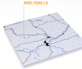 Places with similar names to Neelysville, United States - USA ::
// Nilesville (US)
// Neelsville (US)
// Nellsville (US)
// Knowlesville (US)
// Niles Valley (US)
// Nielsville (US)
// Knellsville (US)
// Neillsville (US)
Disclaimer :: Information on this page comes without warranty of any kind |
||
|
Where is Neelysville? Elevation and coordinates ::
Latitude (lat): 39°37'37"N Longitude (lon): 81°46'40"W
Elevation (approx.): 293m (map arrows pan, magnifying glasses zoom) |
||
|
Visiting Neelysville? Hotel/Accommodation ::
Book a hotel in Neelysville Travel Guide ::
rental cars ::
car rental offers GPS waypoint ::
download a GPX waypoint (PoI) of Neelysville for your GPS receiver
|
||