|
search place name
|
||
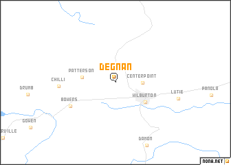
Degnan (Oklahoma, United States - USA)Degnan is a town in the Oklahoma region of United States - USA. An overview map of the region around Degnan is displayed below.
regional and 3d topo map of Degnan, United States - USA ::
Degnan airports ::
The nearest airport is MLC - Mcalester Mc Alester Rgnl, located 40.0 km west of Degnan.
Other airports nearby include FSM - Fort Smith Rgnl (99.7 km north east), TUL - Tulsa Intl (147.0 km north), FYV - Fayetteville Drake Fld (159.1 km north east), TXK - Texarkana Rgnl Webb Fld (207.9 km south east), Nearby towns ::
Center Point (3.6km east) //
Patterson (4.5km west) //
Wilburton (5.1km south east) //
Bowers (7.2km south west) //
[all distances 'as the bird flies' and approximate]  Places with similar names to Degnan, United States - USA ::
// Taganan (MM)
// Daukniūnai (LT)
// Daukniūnai (LT)
// Taganana (ES)
// Dehkānān (IR)
// Dehqānān (IR)
// Deh Qānūn (IR)
// Takanoun (TD)
// Diagnon (SN)
// Dougnane (SN)
Disclaimer :: Information on this page comes without warranty of any kind |
||
|
Where is Degnan? Elevation and coordinates ::
Latitude (lat): 34°56'50"N Longitude (lon): 95°21'11"W
Elevation (approx.): 203m (map arrows pan, magnifying glasses zoom) |
||
|
Visiting Degnan? Hotel/Accommodation ::
Book a hotel in Degnan Travel Guide ::
rental cars ::
car rental offers GPS waypoint ::
download a GPX waypoint (PoI) of Degnan for your GPS receiver
|
||