|
search place name
|
||
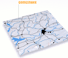
Going Snake (Oklahoma, United States - USA)Going Snake is a town in the Oklahoma region of United States - USA. An overview map of the region around Going Snake is displayed below.
regional and 3d topo map of Going Snake, United States - USA ::

Going Snake airports ::
The nearest airport is FYV - Fayetteville Drake Fld, located 43.3 km east of Going Snake.
Other airports nearby include FSM - Fort Smith Rgnl (77.1 km south), TUL - Tulsa Intl (113.8 km west), HRO - Harrison Boone Co (137.9 km east), MLC - Mcalester Mc Alester Rgnl (160.4 km south west), Nearby towns ::
 Places with similar names to Going Snake, United States - USA ::
// Ganie-Kasenga (CD)
// Kongsong (MM)
// Can Xang (VN)
// Keo Ngsàng (VN)
// Ganxiang (CN)
// Guangzong (CN)
// Guanxing (CN)
// Qianxiang (CN)
// Qianxiang (CN)
// Qianxiang (CN)
Disclaimer :: Information on this page comes without warranty of any kind |
||
|
Where is Going Snake? Elevation and coordinates ::
Latitude (lat): 35°59'30"N Longitude (lon): 94°39'0"W
Elevation (approx.): 288m (map arrows pan, magnifying glasses zoom) |
||
|
Visiting Going Snake? Hotel/Accommodation ::
Book a hotel in Going Snake Travel Guide ::
rental cars ::
car rental offers GPS waypoint ::
download a GPX waypoint (PoI) of Going Snake for your GPS receiver
|
||