|
search place name
|
||
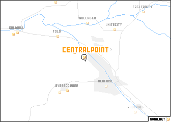
Central Point (Oregon, United States - USA)Central Point is a town in the Oregon region of United States - USA. An overview map of the region around Central Point is displayed below.
regional and 3d topo map of Central Point, United States - USA ::
Nearby towns ::
Seven Oaks (2.5km north west) //
Four Corners (3.0km north east) //
Medford (6.4km south east) //
Bybee Corner (7.2km south west) //
Tolo (7.0km north west) //
Table Rock (8.4km north) //
Jacksonville (8.1km south west) //
White City (8.3km north east) //
[all distances 'as the bird flies' and approximate]  Places with similar names to Central Point, United States - USA ::
// Central Point (US)
// Central Point (US)
Disclaimer :: Information on this page comes without warranty of any kind |
||
|
Where is Central Point? Elevation and coordinates ::
Latitude (lat): 42°22'34"N Longitude (lon): 122°54'55"W
Elevation (approx.): 391m (map arrows pan, magnifying glasses zoom) |
||
|
Visiting Central Point? Hotel/Accommodation ::
Book a hotel in Central Point Travel Guide ::
rental cars ::
car rental offers GPS waypoint ::
download a GPX waypoint (PoI) of Central Point for your GPS receiver
|
||