|
search place name
|
||
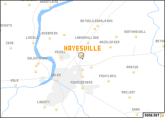
Hayesville (Oregon, United States - USA)Hayesville is a town in the Oregon region of United States - USA. An overview map of the region around Hayesville is displayed below.
regional and 3d topo map of Hayesville, United States - USA ::
Hayesville airports ::
The nearest airport is MMV - Mackminnville Mc Minnville Muni, located 26.1 km north west of Hayesville.
Other airports nearby include PDX - Portland Intl (73.4 km north east), Nearby towns ::
Chemawa (1.9km north west) //
Oak Park (2.4km south) //
Middle Grove (2.3km south east) //
Labish Village (3.8km north) //
Badger Corner (4.0km south) //
Keizer (3.4km west) //
Four Corners (6.5km south) //
Hazel Green (5.2km north east) //
Clear Lake (6.3km north west) //
Brooks (7.2km north) //
Salem (6.3km south west) //
Fruitland (6.5km south east) //
Bethel Gospel Park (7.9km north) //
Lakebrook (7.1km north west) //
Labish Center (7.5km north east) //
[all distances 'as the bird flies' and approximate] 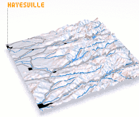 Places with similar names to Hayesville, United States - USA ::
// Hayesville (US)
// Hayesville (US)
// Hayesville (US)
// Hayesville (US)
// Hayesville (US)
// Hayesville (US)
// Hayesville (US)
Disclaimer :: Information on this page comes without warranty of any kind |
||
|
Where is Hayesville? Elevation and coordinates ::
Latitude (lat): 44°59'10"N Longitude (lon): 122°58'54"W
Elevation (approx.): 57m (map arrows pan, magnifying glasses zoom) |
||
|
Visiting Hayesville? Hotel/Accommodation ::
Book a hotel in Hayesville Travel Guide ::
rental cars ::
car rental offers GPS waypoint ::
download a GPX waypoint (PoI) of Hayesville for your GPS receiver
|
||