|
search place name
|
||
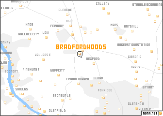
Bradford Woods (Pennsylvania, United States - USA)Bradford Woods is a town in the Pennsylvania region of United States - USA. An overview map of the region around Bradford Woods is displayed below.
regional and 3d topo map of Bradford Woods, United States - USA ::
Bradford Woods airports ::
The nearest airport is PIT - Pittsburgh (pennsylva) Pittsburgh Intl, located 20.6 km south west of Bradford Woods.
Other airports nearby include YNG - Youngstown Warren Rgnl (85.5 km north west), AKR - Akron Fulton Intl (125.0 km west), AOO - Altoona Blair Co (154.2 km east), CLE - Cleveland Hopkins Intl (171.7 km north west), Nearby towns ::
Warrendale (1.8km north) //
Wexford (2.5km south east) //
Criders Corners (5.6km north) //
Hendersonville (5.9km north) //
Franklin Park (6.0km south) //
Seven Fields (6.2km north) //
Duff City (5.7km south west) //
Ingomar (6.5km south) //
Keown (6.5km south east) //
Fox Run (7.2km north) //
Thielman Crossroads (7.0km north east) //
Ogle (7.7km north) //
Fernway (7.6km north west) //
Sewickley Hills (7.8km south west) //
Wall Rose (6.7km west) //
Lovi (7.7km north west) //
Mars (8.8km north east) //
Fox Ridge (9.5km south east) //
[all distances 'as the bird flies' and approximate]  Places with similar names to Bradford Woods, United States - USA :: Disclaimer :: Information on this page comes without warranty of any kind |
||
|
Where is Bradford Woods? Elevation and coordinates ::
Latitude (lat): 40°38'15"N Longitude (lon): 80°4'55"W
Elevation (approx.): 375m (map arrows pan, magnifying glasses zoom) |
||
|
Visiting Bradford Woods? Hotel/Accommodation ::
Book a hotel in Bradford Woods Travel Guide ::
rental cars ::
car rental offers GPS waypoint ::
download a GPX waypoint (PoI) of Bradford Woods for your GPS receiver
|
||