|
search place name
|
||
Cadogan (Pennsylvania, United States - USA)Cadogan is a town in the Pennsylvania region of United States - USA. An overview map of the region around Cadogan is displayed below.
regional and 3d topo map of Cadogan, United States - USA ::

Cadogan airports ::
The nearest airport is PIT - Pittsburgh (pennsylva) Pittsburgh Intl, located 62.4 km south west of Cadogan.
Other airports nearby include YNG - Youngstown Warren Rgnl (108.1 km north west), AOO - Altoona Blair Co (118.3 km south east), AKR - Akron Fulton Intl (162.0 km west), EKN - Elkins Randolph Co Jennings Randolph (208.4 km south), Nearby towns ::
North Buffalo (1.0km north) //
West Ford City (1.7km north east) //
Rosston (2.5km east) //
McVille (3.6km south west) //
McHaddon (4.0km north) //
Rossford (3.6km east) //
Center Hill (4.9km north) //
Sistersville (4.4km north west) //
Clinton (5.3km south) //
Ford Cliff (4.1km east) //
Center Valley (5.3km south) //
Manor Heights (4.3km east) //
Ford City (4.8km north east) //
Christy Manor (4.7km east) //
Neale (5.9km south) //
Stringtown (5.0km east) //
Fordview (5.2km east) //
Dog Town (5.5km north east) //
Lenape Heights (5.2km east) //
Cooks Summit (6.3km south east) //
Slate Lick (5.4km west) //
Pattonville (5.6km north east) //
McGrann (5.9km north east) //
Kerr (5.8km west) //
Manorville (6.4km north east) //
Van Dykes (6.8km south west) //
West Kittanning (7.6km north east) //
Godfrey (7.9km south west) //
Garretts Run (7.2km north east) //
[all distances 'as the bird flies' and approximate] 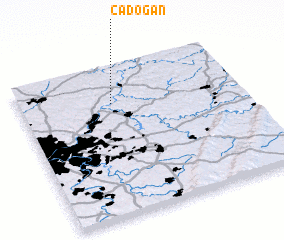 Places with similar names to Cadogan, United States - USA ::
Disclaimer :: Information on this page comes without warranty of any kind |
||
|
Where is Cadogan? Elevation and coordinates ::
Latitude (lat): 40°45'14"N Longitude (lon): 79°34'53"W
Elevation (approx.): 272m (map arrows pan, magnifying glasses zoom) |
||
|
Visiting Cadogan? Hotel/Accommodation ::
Book a hotel in Cadogan Travel Guide ::
rental cars ::
car rental offers GPS waypoint ::
download a GPX waypoint (PoI) of Cadogan for your GPS receiver
|
||