|
search place name
|
||
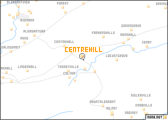
Centre Hill (Pennsylvania, United States - USA)Centre Hill is a town in the Pennsylvania region of United States - USA. An overview map of the region around Centre Hill is displayed below.
regional and 3d topo map of Centre Hill, United States - USA ::
Centre Hill airports ::
The nearest airport is IPT - Williamsport Rgnl, located 77.0 km north east of Centre Hill.
Other airports nearby include AOO - Altoona Blair Co (81.3 km south west), MUI - Muir Aaf (100.6 km south east), MDT - Harrisburg Intl (102.1 km south east), APG - Aberdeen Phillips Aaf (196.0 km south east), Nearby towns ::
Red Mill (2.0km south) //
Old Fort (2.8km north west) //
Potters Mills (3.1km south east) //
Tusseyville (3.6km south west) //
Fruittown (4.8km south) //
Colyer (4.5km south west) //
Centre Hall (4.6km north west) //
Farmers Mills (6.2km north east) //
Locust Grove (5.5km east) //
Spring Mills (7.7km north east) //
[all distances 'as the bird flies' and approximate] 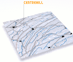 Places with similar names to Centre Hill, United States - USA ::
// Center Hill (US)
// Center Hill (US)
// Center Hill (US)
// Center Hill (US)
// Center Hill (US)
// Center Hill (US)
// Center Hill (US)
// Center Hill (US)
// Center Hill (US)
// Center Hill (US)
Disclaimer :: Information on this page comes without warranty of any kind |
||
|
Where is Centre Hill? Elevation and coordinates ::
Latitude (lat): 40°49'7"N Longitude (lon): 77°38'49"W
Elevation (approx.): 376m (map arrows pan, magnifying glasses zoom) |
||
|
Visiting Centre Hill? Hotel/Accommodation ::
Book a hotel in Centre Hill Travel Guide ::
rental cars ::
car rental offers GPS waypoint ::
download a GPX waypoint (PoI) of Centre Hill for your GPS receiver
|
||