|
search place name
|
||
Chalfant (Pennsylvania, United States - USA)Chalfant is a town in the Pennsylvania region of United States - USA. An overview map of the region around Chalfant is displayed below.
regional and 3d topo map of Chalfant, United States - USA ::

Chalfant airports ::
The nearest airport is PIT - Pittsburgh (pennsylva) Pittsburgh Intl, located 34.6 km west of Chalfant.
Other airports nearby include YNG - Youngstown Warren Rgnl (118.2 km north west), AOO - Altoona Blair Co (129.7 km east), AKR - Akron Fulton Intl (154.2 km north west), EKN - Elkins Randolph Co Jennings Randolph (168.7 km south), Nearby towns ::
North Braddock (1.1km south) //
East Pittsburgh (1.5km south) //
Turtle Creek (1.2km east) //
Forest Hills (1.6km north west) //
Bessemer Junction (1.8km south) //
West Wilmerding (1.9km south east) //
Port Perry (2.2km south west) //
Bessemer (2.0km south west) //
Newtown (2.2km north east) //
Braddock Hills (2.4km north west) //
Linhart (2.6km north east) //
Braddock (2.6km west) //
Churchill (3.3km north) //
Oak Hill (2.9km north east) //
Kennywood Park (3.2km south west) //
Wilmerding (3.1km south east) //
Duquesne (3.5km south west) //
Eastmont (3.8km north east) //
Fite Station (4.3km south) //
Rankin (3.4km west) //
North Versailles (4.1km south east) //
East McKeesport (4.0km south east) //
Homeville (4.2km south west) //
Swissvale (4.1km north west) //
Shadow Shuttle (5.1km north) //
Black Ridge (5.3km north) //
Edgewood (4.4km north west) //
Riverton (5.6km south) //
Churchill Valley (5.6km north) //
[all distances 'as the bird flies' and approximate] 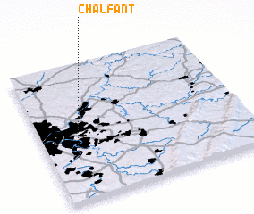 Places with similar names to Chalfant, United States - USA ::
Disclaimer :: Information on this page comes without warranty of any kind |
||
|
Where is Chalfant? Elevation and coordinates ::
Latitude (lat): 40°24'31"N Longitude (lon): 79°50'21"W
Elevation (approx.): 295m (map arrows pan, magnifying glasses zoom) |
||
|
Visiting Chalfant? Hotel/Accommodation ::
Book a hotel in Chalfant Travel Guide ::
rental cars ::
car rental offers GPS waypoint ::
download a GPX waypoint (PoI) of Chalfant for your GPS receiver
|
||