|
search place name
|
||
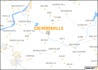
Cochrans Mills (Pennsylvania, United States - USA)Cochrans Mills is a town in the Pennsylvania region of United States - USA. An overview map of the region around Cochrans Mills is displayed below.
regional and 3d topo map of Cochrans Mills, United States - USA ::
Cochrans Mills airports ::
The nearest airport is PIT - Pittsburgh (pennsylva) Pittsburgh Intl, located 68.5 km west of Cochrans Mills.
Other airports nearby include AOO - Altoona Blair Co (105.1 km south east), YNG - Youngstown Warren Rgnl (121.9 km north west), EKN - Elkins Randolph Co Jennings Randolph (200.6 km south), Nearby towns ::
Brick Church (1.8km north) //
Mateer (3.4km south) //
Top (4.6km north) //
Girty (4.7km south east) //
Pyrra (6.3km north east) //
Shady Plain (6.7km south) //
Rockville (7.1km north) //
Old Gum Tree (5.6km west) //
Shay (7.4km north) //
Spring Church (7.6km south) //
Dime (6.5km west) //
Whitesburg (9.6km north east) //
Christy Manor (9.6km north west) //
[all distances 'as the bird flies' and approximate] 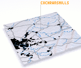 Places with similar names to Cochrans Mills, United States - USA :: Disclaimer :: Information on this page comes without warranty of any kind |
||
|
Where is Cochrans Mills? Elevation and coordinates ::
Latitude (lat): 40°40'12"N Longitude (lon): 79°27'30"W
Elevation (approx.): 302m (map arrows pan, magnifying glasses zoom) |
||
|
Visiting Cochrans Mills? Hotel/Accommodation ::
Book a hotel in Cochrans Mills Travel Guide ::
rental cars ::
car rental offers GPS waypoint ::
download a GPX waypoint (PoI) of Cochrans Mills for your GPS receiver
|
||