|
search place name
|
||
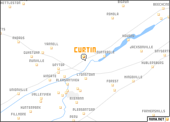
Curtin (Pennsylvania, United States - USA)Curtin is a town in the Pennsylvania region of United States - USA. An overview map of the region around Curtin is displayed below.
regional and 3d topo map of Curtin, United States - USA ::
Curtin airports ::
The nearest airport is IPT - Williamsport Rgnl, located 75.3 km north east of Curtin.
Other airports nearby include AOO - Altoona Blair Co (89.5 km south west), MUI - Muir Aaf (115.8 km south east), MDT - Harrisburg Intl (119.9 km south east), APG - Aberdeen Phillips Aaf (214.3 km south east), Nearby towns ::
Lyonstown (3.9km south) //
Mount Eagle (3.4km east) //
Milesburg (4.8km south west) //
Dry Top (4.7km west) //
Park View Heights (6.2km south) //
Central City (5.1km south west) //
Pleasant View (5.9km south west) //
East End (6.6km south) //
Bellefonte (7.2km south west) //
Yarnell (6.3km north west) //
Forest (7.0km south east) //
Big Spring (7.7km south west) //
Wingate (7.2km south west) //
Bush Addition (8.4km south west) //
Coleville (8.3km south west) //
Zion (8.1km south east) //
[all distances 'as the bird flies' and approximate] 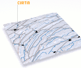 Places with similar names to Curtin, United States - USA ::
Disclaimer :: Information on this page comes without warranty of any kind |
||
|
Where is Curtin? Elevation and coordinates ::
Latitude (lat): 40°58'20"N Longitude (lon): 77°44'39"W
Elevation (approx.): 208m (map arrows pan, magnifying glasses zoom) |
||
|
Visiting Curtin? Hotel/Accommodation ::
Book a hotel in Curtin Travel Guide ::
rental cars ::
car rental offers GPS waypoint ::
download a GPX waypoint (PoI) of Curtin for your GPS receiver
|
||