|
search place name
|
||
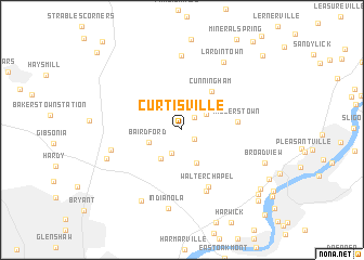
Curtisville (Pennsylvania, United States - USA)Curtisville is a town in the Pennsylvania region of United States - USA. An overview map of the region around Curtisville is displayed below.
regional and 3d topo map of Curtisville, United States - USA ::
Curtisville airports ::
The nearest airport is PIT - Pittsburgh (pennsylva) Pittsburgh Intl, located 36.4 km south west of Curtisville.
Other airports nearby include YNG - Youngstown Warren Rgnl (97.9 km north west), AOO - Altoona Blair Co (135.4 km east), AKR - Akron Fulton Intl (143.2 km west), CLE - Cleveland Hopkins Intl (188.6 km north west), Nearby towns ::
Benjamin (1.3km south east) //
Culmerville (1.7km north east) //
Magill Heights (2.5km south) //
Red Hot (2.6km north east) //
Blanchard (2.5km north east) //
Bairdford (2.9km south west) //
Allegheny Acres (3.4km south west) //
Russellton (3.6km south) //
Cunningham (4.6km north east) //
Millerstown (4.5km east) //
Walter Chapel (6.2km south) //
Rural Ridge (6.6km south) //
Fawn Haven Number One (5.9km west) //
Ivywood (7.6km north) //
Lardintown (7.7km north east) //
Indianola (8.2km south) //
Fawn Haven Number Two (6.6km south west) //
Dorseyville (7.9km south west) //
Broadview (7.3km south east) //
Creighton (8.7km south east) //
Hites (9.0km south east) //
Glassmere (9.4km south east) //
Ekastown (9.9km north east) //
Cooperstown (10.4km north west) //
West New Kensington (10.9km south east) //
[all distances 'as the bird flies' and approximate]  Places with similar names to Curtisville, United States - USA ::
// Gourdsville (US)
// Kritesville (US)
// Curtisville (US)
// Kratzville (US)
// Curdsville (US)
// Curtisville (US)
// Curtisville (US)
// Cardsville (US)
// Critesville (US)
// Garrattsville (US)
Disclaimer :: Information on this page comes without warranty of any kind |
||
|
Where is Curtisville? Elevation and coordinates ::
Latitude (lat): 40°38'32"N Longitude (lon): 79°51'4"W
Elevation (approx.): 315m (map arrows pan, magnifying glasses zoom) |
||
|
Visiting Curtisville? Hotel/Accommodation ::
Book a hotel in Curtisville Travel Guide ::
rental cars ::
car rental offers GPS waypoint ::
download a GPX waypoint (PoI) of Curtisville for your GPS receiver
|
||