|
search place name
|
||
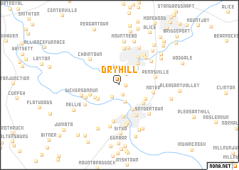
Dry Hill (Pennsylvania, United States - USA)Dry Hill is a town in the Pennsylvania region of United States - USA. An overview map of the region around Dry Hill is displayed below.
regional and 3d topo map of Dry Hill, United States - USA ::
Dry Hill airports ::
The nearest airport is PIT - Pittsburgh (pennsylva) Pittsburgh Intl, located 71.1 km north west of Dry Hill.
Other airports nearby include AOO - Altoona Blair Co (113.3 km east), EKN - Elkins Randolph Co Jennings Randolph (131.7 km south), YNG - Youngstown Warren Rgnl (160.8 km north west), AKR - Akron Fulton Intl (190.8 km north west), Nearby towns ::
Morgan (0.8km east) //
Broad Ford (1.6km south) //
Owensdale (1.9km north east) //
Adelaide (2.1km south west) //
Crossland (2.7km south) //
Raineytown (3.4km south west) //
Hulltown (3.5km south west) //
North Manor (4.2km south east) //
Everson (4.0km north east) //
Coldbrook (3.9km south east) //
Poplar Grove (4.1km south east) //
Dawson (3.8km south west) //
New Haven (5.0km south) //
Scottdale (4.9km north east) //
Connellsville (5.2km south east) //
Moyer (4.3km east) //
Liberty (4.5km south west) //
Miedel Hill (5.7km north) //
Pennsville (4.5km east) //
Trotter (5.8km south) //
Kingview (5.3km north east) //
Pinetree (5.9km north) //
Keifertown (5.6km north east) //
Dickerson Run (4.8km west) //
Chaintown (5.4km north west) //
Vanderbilt (5.1km south west) //
Walnut Hill (5.3km north east) //
Greenwood Heights (6.2km south) //
Wheeler (6.4km south) //
[all distances 'as the bird flies' and approximate]  Places with similar names to Dry Hill, United States - USA ::
// Douar Rahalia (MA)
// Douar Rhila (MA)
// Dry Hill (US)
// Terhalle (DE)
// Turhal (TR)
// Terhalla (TN)
// Tarahal (ES)
// Torrihuela (ES)
// Dryhill (US)
// Tar Hill (US)
Disclaimer :: Information on this page comes without warranty of any kind |
||
|
Where is Dry Hill? Elevation and coordinates ::
Latitude (lat): 40°3'39"N Longitude (lon): 79°36'50"W
Elevation (approx.): 361m (map arrows pan, magnifying glasses zoom) |
||
|
Visiting Dry Hill? Hotel/Accommodation ::
Book a hotel in Dry Hill Travel Guide ::
rental cars ::
car rental offers GPS waypoint ::
download a GPX waypoint (PoI) of Dry Hill for your GPS receiver
|
||