|
search place name
|
||
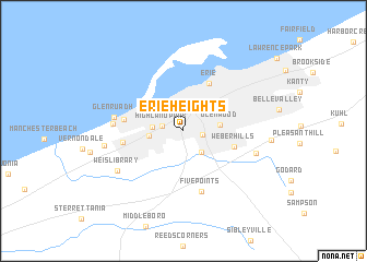
Erie Heights (Pennsylvania, United States - USA)Erie Heights is a town in the Pennsylvania region of United States - USA. An overview map of the region around Erie Heights is displayed below.
regional and 3d topo map of Erie Heights, United States - USA ::
Erie Heights airports ::
The nearest airport is YNG - Youngstown Warren Rgnl, located 103.1 km south west of Erie Heights.
Other airports nearby include YHM - Hamilton (121.8 km north), YXU - London (136.0 km north west), BUF - Buffalo Niagara Intl (147.8 km north east), IAG - Niagara Falls Intl (148.3 km north east), Nearby towns ::
Chestnut Hill (1.6km east) //
Highland Park (1.7km west) //
Dock Junction (2.5km north) //
Kearsarge (2.5km south east) //
Charter Oaks (2.4km west) //
Westminster (2.7km west) //
Glenwood (2.8km east) //
Weber Hills (4.2km south east) //
Erie (5.3km north) //
Eaglehurst (4.6km west) //
West Millcreek (4.8km west) //
Five Points (6.4km south) //
Glenruadh (5.4km west) //
Lakewood (5.4km west) //
Glenmar Gardens (6.0km south east) //
Weis Library (6.5km south west) //
Asbury (6.2km west) //
[all distances 'as the bird flies' and approximate] 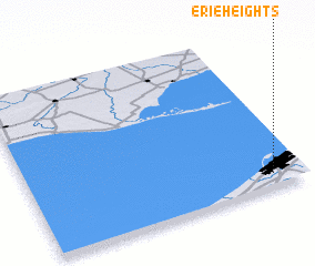 Places with similar names to Erie Heights, United States - USA :: Disclaimer :: Information on this page comes without warranty of any kind |
||
|
Where is Erie Heights? Elevation and coordinates ::
Latitude (lat): 42°5'6"N Longitude (lon): 80°6'33"W
Elevation (approx.): 260m (map arrows pan, magnifying glasses zoom) |
||
|
Visiting Erie Heights? Hotel/Accommodation ::
Book a hotel in Erie Heights Travel Guide ::
rental cars ::
car rental offers GPS waypoint ::
download a GPX waypoint (PoI) of Erie Heights for your GPS receiver
|
||