|
search place name
|
||
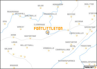
Fort Littleton (Pennsylvania, United States - USA)Fort Littleton is a town in the Pennsylvania region of United States - USA. An overview map of the region around Fort Littleton is displayed below.
regional and 3d topo map of Fort Littleton, United States - USA ::
Fort Littleton airports ::
The nearest airport is AOO - Altoona Blair Co, located 39.9 km north west of Fort Littleton.
Other airports nearby include MDT - Harrisburg Intl (103.3 km east), MUI - Muir Aaf (125.6 km east), IAD - Washington Dulles Intl (131.6 km south), BWI - Baltimore Washington Intl (148.6 km south east), Nearby towns ::
Clear Ridge (4.0km north west) //
Knobsville (6.1km south) //
Maddensville (7.1km north) //
Hustontown (5.6km west) //
Burnt Cabins (6.0km east) //
Cowans Village (8.0km south east) //
Dublin Mills (8.4km north west) //
Sweetwater (7.8km south east) //
Mellotts Mill (8.1km south west) //
Mentzer (9.6km north east) //
[all distances 'as the bird flies' and approximate] 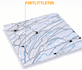 Places with similar names to Fort Littleton, United States - USA :: Disclaimer :: Information on this page comes without warranty of any kind |
||
|
Where is Fort Littleton? Elevation and coordinates ::
Latitude (lat): 40°3'46"N Longitude (lon): 77°57'50"W
Elevation (approx.): 250m (map arrows pan, magnifying glasses zoom) |
||
|
Visiting Fort Littleton? Hotel/Accommodation ::
Book a hotel in Fort Littleton Travel Guide ::
rental cars ::
car rental offers GPS waypoint ::
download a GPX waypoint (PoI) of Fort Littleton for your GPS receiver
|
||