|
search place name
|
||
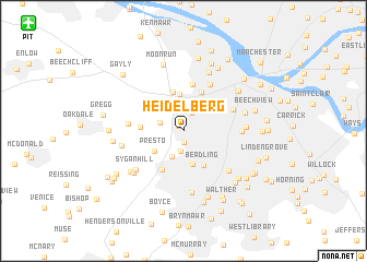
Heidelberg (Pennsylvania, United States - USA)Heidelberg is a town in the Pennsylvania region of United States - USA. An overview map of the region around Heidelberg is displayed below.
regional and 3d topo map of Heidelberg, United States - USA ::
Heidelberg airports ::
The nearest airport is PIT - Pittsburgh (pennsylva) Pittsburgh Intl, located 16.3 km north west of Heidelberg.
Other airports nearby include YNG - Youngstown Warren Rgnl (108.5 km north west), AKR - Akron Fulton Intl (136.6 km north west), AOO - Altoona Blair Co (150.9 km east), EKN - Elkins Randolph Co Jennings Randolph (168.1 km south), Nearby towns ::
Glendale (0.6km north west) //
Woodville (1.1km south) //
Carnegie (1.9km north) //
Bower Hill (2.1km south) //
Ewingsville (2.0km north west) //
Kirwan Heights (2.8km south) //
East Carnegie (2.9km north east) //
Rook (3.1km north east) //
Essen (3.4km south) //
Presto (3.1km south west) //
Rosslyn Farms (3.7km north) //
Beadling (3.9km south east) //
Pennsbury Village (4.1km north) //
Idlewood (4.2km north) //
Walkers Mill (3.4km west) //
Bridgeville (4.3km south) //
Thornburg (4.8km north) //
Green Tree (4.4km north east) //
Crafton (5.2km north east) //
Rennerdale (4.3km west) //
South Hills (4.5km east) //
Mount Lebanon (5.4km south east) //
Sygan Hill (5.5km south west) //
Upper Sainte Clair (6.3km south) //
Dormont (4.9km east) //
Federal (5.1km west) //
Ingram (6.3km north) //
Banksville (5.2km east) //
Sygan (5.8km south west) //
[all distances 'as the bird flies' and approximate]  Places with similar names to Heidelberg, United States - USA ::
// Hattelberg (AT)
// Hedelberg (DE)
// Heidelberg (DE)
// Heidelberg (DE)
// Heidelberg (DE)
// Heidelberg (ZA)
// Heidelberg (ZA)
// Heidelberg (US)
// Heidelberg (US)
// Heidelberg (US)
Disclaimer :: Information on this page comes without warranty of any kind |
||
|
Where is Heidelberg? Elevation and coordinates ::
Latitude (lat): 40°23'32"N Longitude (lon): 80°5'28"W
Elevation (approx.): 252m (map arrows pan, magnifying glasses zoom) |
||
|
Visiting Heidelberg? Hotel/Accommodation ::
Book a hotel in Heidelberg Travel Guide ::
rental cars ::
car rental offers GPS waypoint ::
download a GPX waypoint (PoI) of Heidelberg for your GPS receiver
|
||