|
search place name
|
||
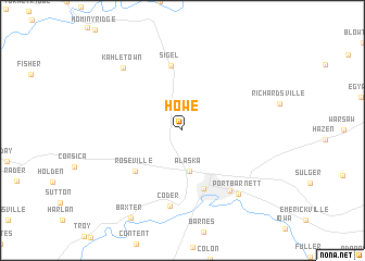
Howe (Pennsylvania, United States - USA)Howe is a town in the Pennsylvania region of United States - USA. An overview map of the region around Howe is displayed below.
regional and 3d topo map of Howe, United States - USA ::
Howe airports ::
The nearest airport is AOO - Altoona Blair Co, located 121.5 km south east of Howe.
Other airports nearby include PIT - Pittsburgh (pennsylva) Pittsburgh Intl (124.7 km south west), YNG - Youngstown Warren Rgnl (132.3 km west), BUF - Buffalo Niagara Intl (194.1 km north), IAG - Niagara Falls Intl (210.6 km north), Nearby towns ::
Alaska (4.2km south) //
Brookville (6.2km south) //
Roseville (5.5km south west) //
Sigel (6.7km north) //
Pinecreek (7.2km south east) //
Coder (7.9km south) //
Port Barnett (7.8km south east) //
Kahletown (7.9km north west) //
[all distances 'as the bird flies' and approximate] 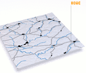 Places with similar names to Howe, United States - USA ::
Disclaimer :: Information on this page comes without warranty of any kind |
||
|
Where is Howe? Elevation and coordinates ::
Latitude (lat): 41°12'54"N Longitude (lon): 79°6'9"W
Elevation (approx.): 492m (map arrows pan, magnifying glasses zoom) |
||
|
Visiting Howe? Hotel/Accommodation ::
Book a hotel in Howe Travel Guide ::
rental cars ::
car rental offers GPS waypoint ::
download a GPX waypoint (PoI) of Howe for your GPS receiver
|
||