|
search place name
|
||
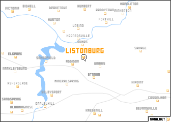
Listonburg (Pennsylvania, United States - USA)Listonburg is a town in the Pennsylvania region of United States - USA. An overview map of the region around Listonburg is displayed below.
regional and 3d topo map of Listonburg, United States - USA ::
Listonburg airports ::
The nearest airport is AOO - Altoona Blair Co, located 104.0 km north east of Listonburg.
Other airports nearby include EKN - Elkins Randolph Co Jennings Randolph (106.9 km south west), PIT - Pittsburgh (pennsylva) Pittsburgh Intl (113.2 km north west), IAD - Washington Dulles Intl (183.7 km south east), YNG - Youngstown Warren Rgnl (203.3 km north west), Nearby towns ::
Beachly (2.2km north) //
Addison (2.3km west) //
Dumas (3.5km north) //
Unamis (2.8km south east) //
Strawn (4.0km south) //
Harnedsville (4.9km north) //
Mineral Spring (6.0km south west) //
Ursina (7.1km north) //
Confluence (7.4km north west) //
Somerfield (6.6km west) //
Fort Hill (9.1km north east) //
Selbysport (9.5km south west) //
Huston (9.8km north west) //
[all distances 'as the bird flies' and approximate] 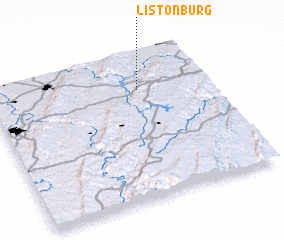 Places with similar names to Listonburg, United States - USA ::
// Listenberg (AT)
// Listenberg (DE)
Disclaimer :: Information on this page comes without warranty of any kind |
||
|
Where is Listonburg? Elevation and coordinates ::
Latitude (lat): 39°45'17"N Longitude (lon): 79°18'52"W
Elevation (approx.): 528m (map arrows pan, magnifying glasses zoom) |
||
|
Visiting Listonburg? Hotel/Accommodation ::
Book a hotel in Listonburg Travel Guide ::
rental cars ::
car rental offers GPS waypoint ::
download a GPX waypoint (PoI) of Listonburg for your GPS receiver
|
||