|
search place name
|
||
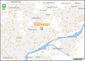
Normandy (Pennsylvania, United States - USA)Normandy is a town in the Pennsylvania region of United States - USA. An overview map of the region around Normandy is displayed below.
regional and 3d topo map of Normandy, United States - USA ::
Normandy airports ::
The nearest airport is NXX - Willow Grove Nas Jrb, located 16.8 km north west of Normandy.
Other airports nearby include TTN - Trenton Mercer (24.7 km north east), PHL - Philadelphia Intl (33.1 km south west), WRI - Wrightstown Mc Guire Afb (35.9 km east), NEL - Lakehurst Naes (55.4 km east), Nearby towns ::
Linconia (2.7km north east) //
Modena Park (2.9km south) //
Somerton (2.8km north west) //
Byberry (2.4km east) //
Longmead Farms (2.8km south east) //
Morrell Park (3.4km south) //
West Torresdale (3.4km south) //
Mechanicsville (2.7km east) //
La Trappe (3.3km north east) //
Nottingham (3.0km north east) //
Milbrook (3.3km south east) //
Crestmont Farms (3.7km south east) //
Calico Corner (3.6km north east) //
Pauls Run (3.3km west) //
Trevose (4.2km north) //
Eddington Gardens (3.5km east) //
Kearney (4.2km south east) //
Bustleton (3.8km south west) //
Feasterville (4.6km north) //
Academy Garden (4.6km south) //
Ashton Wooden Bridge (4.2km south west) //
Andalusia (4.3km south east) //
Stanwood (3.7km east) //
Cornwell (4.4km south east) //
Bensalem (3.8km east) //
Pinewoods (4.7km north west) //
Chestnut Wood Village (4.9km south) //
Philmont (4.1km north west) //
Trevose Heights (5.4km north) //
[all distances 'as the bird flies' and approximate]  Places with similar names to Normandy, United States - USA ::
Disclaimer :: Information on this page comes without warranty of any kind |
||
|
Where is Normandy? Elevation and coordinates ::
Latitude (lat): 40°6'12"N Longitude (lon): 74°59'46"W
Elevation (approx.): 45m (map arrows pan, magnifying glasses zoom) |
||
|
Visiting Normandy? Hotel/Accommodation ::
Book a hotel in Normandy Travel Guide ::
rental cars ::
car rental offers GPS waypoint ::
download a GPX waypoint (PoI) of Normandy for your GPS receiver
|
||