|
search place name
|
||
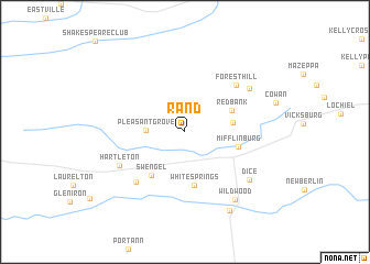
Rand (Pennsylvania, United States - USA)Rand is a town in the Pennsylvania region of United States - USA. An overview map of the region around Rand is displayed below.
regional and 3d topo map of Rand, United States - USA ::
Rand airports ::
The nearest airport is IPT - Williamsport Rgnl, located 37.5 km north east of Rand.
Other airports nearby include MUI - Muir Aaf (70.9 km south east), MDT - Harrisburg Intl (86.7 km south), AOO - Altoona Blair Co (125.3 km south west), APG - Aberdeen Phillips Aaf (180.9 km south east), Nearby towns ::
Pleasant Grove (3.0km west) //
Johnstown (3.8km east) //
Red Bank (4.2km north east) //
White Springs (5.4km south) //
Swengel (5.0km south west) //
Mifflinburg (4.4km east) //
Millmont (6.3km south west) //
Forest Hill (6.2km north east) //
Hartleton (6.1km south west) //
Tannertown (6.6km north east) //
Dice (6.9km south east) //
Wildwood (7.9km south east) //
Penns Creek (8.7km south east) //
[all distances 'as the bird flies' and approximate]  Places with similar names to Rand, United States - USA ::
Disclaimer :: Information on this page comes without warranty of any kind |
||
|
Where is Rand? Elevation and coordinates ::
Latitude (lat): 40°55'53"N Longitude (lon): 77°5'48"W
Elevation (approx.): 207m (map arrows pan, magnifying glasses zoom) |
||
|
Visiting Rand? Hotel/Accommodation ::
Book a hotel in Rand Travel Guide ::
rental cars ::
car rental offers GPS waypoint ::
download a GPX waypoint (PoI) of Rand for your GPS receiver
|
||