|
search place name
|
||
Red Cross (Pennsylvania, United States - USA)Red Cross is a town in the Pennsylvania region of United States - USA. An overview map of the region around Red Cross is displayed below.
regional and 3d topo map of Red Cross, United States - USA ::

Red Cross airports ::
The nearest airport is MUI - Muir Aaf, located 35.8 km south east of Red Cross.
Other airports nearby include MDT - Harrisburg Intl (57.5 km south), IPT - Williamsport Rgnl (60.0 km north), AOO - Altoona Blair Co (137.9 km west), APG - Aberdeen Phillips Aaf (147.9 km south), Nearby towns ::
Otto (1.3km north west) //
Kneass (2.7km north west) //
Urban (3.6km south) //
Dornsife (3.8km north) //
Mandata (4.6km south west) //
Rebuck (4.4km east) //
Hunter (5.6km north east) //
Herndon (4.8km west) //
Patricksburg (7.0km north) //
Hebe (7.0km south east) //
Dundore (6.2km west) //
Pillow (7.9km south) //
Resler (8.2km north) //
Dunkelbergers (7.6km north east) //
Port Trevorton (6.8km west) //
Fishers Ferry (8.1km north west) //
Asherton (9.1km north) //
Hickory Corners (9.0km south west) //
[all distances 'as the bird flies' and approximate] 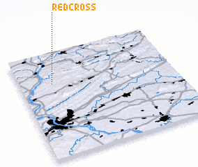 Places with similar names to Red Cross, United States - USA ::
// Rotkreuz (CH)
// Rio de Couros (PT)
// Red Cross (US)
// Red Cross (US)
// Redcross (US)
// Redcross (IE)
// Rooty Cross (IE)
Disclaimer :: Information on this page comes without warranty of any kind |
||
|
Where is Red Cross? Elevation and coordinates ::
Latitude (lat): 40°42'40"N Longitude (lon): 76°47'11"W
Elevation (approx.): 153m (map arrows pan, magnifying glasses zoom) |
||
|
Visiting Red Cross? Hotel/Accommodation ::
Book a hotel in Red Cross Travel Guide ::
rental cars ::
car rental offers GPS waypoint ::
download a GPX waypoint (PoI) of Red Cross for your GPS receiver
|
||