|
search place name
|
||
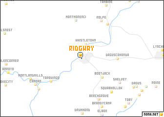
Ridgway (Pennsylvania, United States - USA)Ridgway is a town in the Pennsylvania region of United States - USA. An overview map of the region around Ridgway is displayed below.
regional and 3d topo map of Ridgway, United States - USA ::
Ridgway airports ::
The nearest airport is AOO - Altoona Blair Co, located 129.5 km south of Ridgway.
Other airports nearby include IPT - Williamsport Rgnl (152.6 km east), PIT - Pittsburgh (pennsylva) Pittsburgh Intl (163.3 km south west), YNG - Youngstown Warren Rgnl (164.2 km west), BUF - Buffalo Niagara Intl (168.9 km north), Nearby towns ::
Whistletown (3.3km north) //
Boot Jack (5.6km south east) //
Daguscahonda (6.1km east) //
Tapawingo (7.4km south west) //
Montmorenci (8.7km north) //
Rolfe (9.2km north) //
Johnsonburg (9.0km north east) //
Squab Hollow (9.2km south east) //
Shelvey (8.6km south east) //
[all distances 'as the bird flies' and approximate] 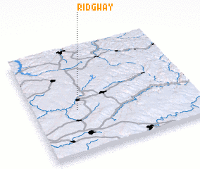 Places with similar names to Ridgway, United States - USA ::
Disclaimer :: Information on this page comes without warranty of any kind |
||
|
Where is Ridgway? Elevation and coordinates ::
Latitude (lat): 41°25'13"N Longitude (lon): 78°43'44"W
Elevation (approx.): 435m (map arrows pan, magnifying glasses zoom) |
||
|
Visiting Ridgway? Hotel/Accommodation ::
Book a hotel in Ridgway Travel Guide ::
rental cars ::
car rental offers GPS waypoint ::
download a GPX waypoint (PoI) of Ridgway for your GPS receiver
|
||