|
search place name
|
||
Sanatoga (Pennsylvania, United States - USA)Sanatoga is a town in the Pennsylvania region of United States - USA. An overview map of the region around Sanatoga is displayed below.
regional and 3d topo map of Sanatoga, United States - USA ::

Sanatoga airports ::
The nearest airport is NXX - Willow Grove Nas Jrb, located 38.4 km east of Sanatoga.
Other airports nearby include PHL - Philadelphia Intl (51.3 km south east), ILG - Wilmington New Castle (62.9 km south), TTN - Trenton Mercer (66.6 km east), MUI - Muir Aaf (85.4 km west), Nearby towns ::
Terrace Hill (0.6km east) //
Ridge Estates (1.7km north) //
Randy Run (1.6km north west) //
Pleasant View Acres (1.9km north east) //
Alto Grandview Acres (2.4km north) //
Fricks Lock (2.5km south) //
Pottsgrove (2.6km north west) //
Ringing Hills (2.9km north) //
Woodgate (2.5km north east) //
Ringing Rock Gardens (3.1km north west) //
Birchwood Terrace (3.7km north) //
Washington Hill (3.1km west) //
Cedar Grove (4.1km north west) //
Kenilworth (3.6km south west) //
Linfield (4.4km south east) //
Fagleysville (4.3km north east) //
Parker Ford (5.2km south) //
Hanover Court (4.1km west) //
Pottstown (4.6km west) //
Snowdenville (6.0km south) //
New Hanover (6.0km north) //
Fruitville (4.8km east) //
South Pottstown (4.8km west) //
Pennhurst (6.2km south) //
Limerick Center (5.1km east) //
Cedar Grove (6.0km north west) //
Barlow Heights (5.7km south east) //
Halfway House (5.8km north west) //
Half Way House (5.9km north west) //
[all distances 'as the bird flies' and approximate] 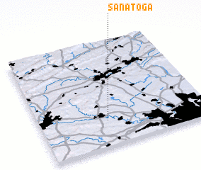 Places with similar names to Sanatoga, United States - USA ::
Disclaimer :: Information on this page comes without warranty of any kind |
||
|
Where is Sanatoga? Elevation and coordinates ::
Latitude (lat): 40°14'42"N Longitude (lon): 75°35'44"W
Elevation (approx.): 74m (map arrows pan, magnifying glasses zoom) |
||
|
Visiting Sanatoga? Hotel/Accommodation ::
Book a hotel in Sanatoga Travel Guide ::
rental cars ::
car rental offers GPS waypoint ::
download a GPX waypoint (PoI) of Sanatoga for your GPS receiver
|
||