|
search place name
|
||
Sandy Creek (Pennsylvania, United States - USA)Sandy Creek is a town in the Pennsylvania region of United States - USA. An overview map of the region around Sandy Creek is displayed below.
regional and 3d topo map of Sandy Creek, United States - USA ::

Sandy Creek airports ::
The nearest airport is PIT - Pittsburgh (pennsylva) Pittsburgh Intl, located 32.6 km west of Sandy Creek.
Other airports nearby include YNG - Youngstown Warren Rgnl (111.8 km north west), AOO - Altoona Blair Co (131.3 km east), AKR - Akron Fulton Intl (150.2 km north west), EKN - Elkins Randolph Co Jennings Randolph (176.1 km south), Nearby towns ::
Laketon Heights (1.4km south west) //
Rosedale (1.6km north east) //
Eastwood (1.9km south west) //
Nadine (1.7km west) //
Black Ridge (2.3km south) //
Blawnox (2.3km north west) //
Churchill Valley (2.2km south east) //
Shannon Heights (2.2km north east) //
Crescent Hills (2.1km east) //
Rodi (2.2km south east) //
Montrose Hill (3.2km north) //
Verona (3.5km north) //
Verona Hills (3.3km north east) //
Peter Mans Corner (2.8km north east) //
Shadow Shuttle (3.5km south east) //
Point Breeze (3.9km north) //
Lincoln Park (3.3km south west) //
Churchill (4.1km south) //
Penn Ridge (3.3km south east) //
Fairview Heights (4.9km north) //
Valemont Heights (4.3km north east) //
Oakmont (5.2km north) //
Eastvue (4.1km east) //
Wilkinsburg (4.7km south west) //
Belmar (4.1km west) //
Brushton (4.4km south west) //
Fox Chapel (5.0km north west) //
Universal (4.4km east) //
Eastmont (5.3km south east) //
[all distances 'as the bird flies' and approximate] 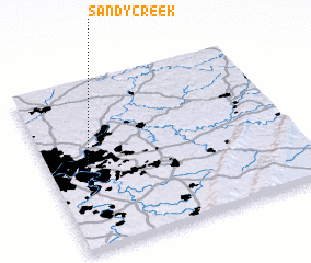 Places with similar names to Sandy Creek, United States - USA ::
// Sandy Creek (US)
// Sandy Creek (US)
// Sandkrug (DE)
// Sandkrug (DE)
// Sandkrug (DE)
// Sandkrug (DE)
// Sandkrug (DE)
// Sandkrug (DE)
// Sandkrug (DE)
// Sandkrug (DE)
Disclaimer :: Information on this page comes without warranty of any kind |
||
|
Where is Sandy Creek? Elevation and coordinates ::
Latitude (lat): 40°28'31"N Longitude (lon): 79°50'55"W
Elevation (approx.): 247m (map arrows pan, magnifying glasses zoom) |
||
|
Visiting Sandy Creek? Hotel/Accommodation ::
Book a hotel in Sandy Creek Travel Guide ::
rental cars ::
car rental offers GPS waypoint ::
download a GPX waypoint (PoI) of Sandy Creek for your GPS receiver
|
||